
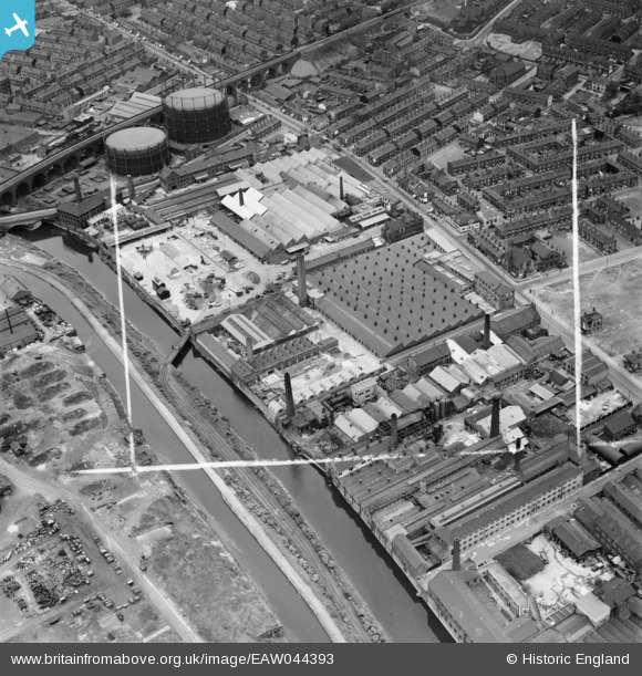
EAW044393 ENGLAND (1952). The British Screw Co Ltd Factory on Kirkstall Road and environs, Leeds, 1952. This image was marked by Aerofilms Ltd for photo editing.
© Copyright OpenStreetMap contributors and licensed by the OpenStreetMap Foundation. 2026. Cartography is licensed as CC BY-SA.
Nearby Images (15)
EAW044393

EAW044390

EAW044387

EAW044391

EAW044389

EAW044388

EAW044394

EAW044392

EAW044386

EAW035540

EPW057177

EPW057173

EPW057175

EPW057176

EPW057174

Details
| Title | [EAW044393] The British Screw Co Ltd Factory on Kirkstall Road and environs, Leeds, 1952. This image was marked by Aerofilms Ltd for photo editing. |
| Reference | EAW044393 |
| Date | 27-June-1952 |
| Link | |
| Place name | LEEDS |
| Parish | |
| District | |
| Country | ENGLAND |
| Easting / Northing | 428178, 434062 |
| Longitude / Latitude | -1.5721131323019, 53.801880098017 |
| National Grid Reference | SE282341 |
Pins

redmist |
Tuesday 29th of November 2022 10:37:44 PM | |
|
redmist |
Tuesday 29th of November 2022 10:37:17 PM | |
|
redmist |
Tuesday 29th of November 2022 10:36:27 PM | |

spugs |
Thursday 14th of April 2016 11:29:56 PM | |
|
spugs |
Thursday 14th of April 2016 11:28:55 PM | |
|
spugs |
Thursday 14th of April 2016 11:25:38 PM | |
|
spugs |
Thursday 14th of April 2016 11:22:55 PM | |
|
spugs |
Wednesday 31st of December 2014 01:59:06 PM |