
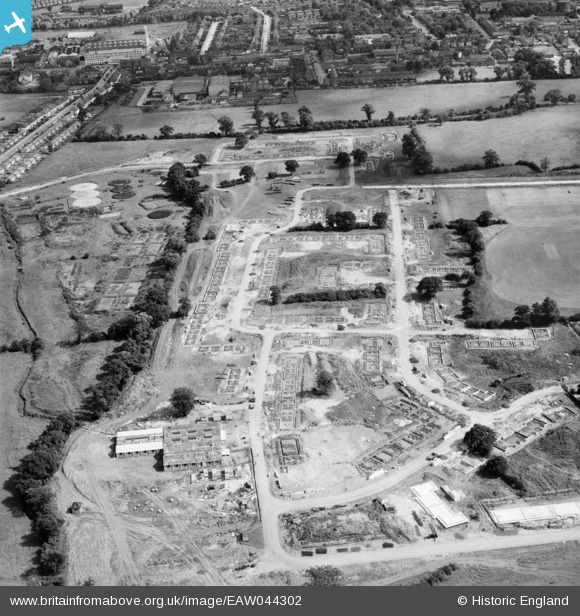
EAW044302 ENGLAND (1952). New housing under construction around Linton Avenue and Croxdale Road, Borehamwood, 1952
© Copyright OpenStreetMap contributors and licensed by the OpenStreetMap Foundation. 2026. Cartography is licensed as CC BY-SA.
Nearby Images (3)
EAW044302

EAW044299

EAW046959

Details
| Title | [EAW044302] New housing under construction around Linton Avenue and Croxdale Road, Borehamwood, 1952 |
| Reference | EAW044302 |
| Date | 24-June-1952 |
| Link | |
| Place name | BOREHAMWOOD |
| Parish | ELSTREE AND BOREHAMWOOD |
| District | |
| Country | ENGLAND |
| Easting / Northing | 519001, 197443 |
| Longitude / Latitude | -0.27924560655002, 51.662687040343 |
| National Grid Reference | TQ190974 |
Pins
Be the first to add a comment to this image!