
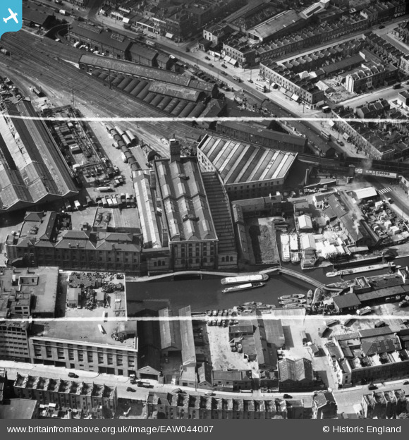
EAW044007 ENGLAND (1952). The Interchange Warehouse, Camden Town, 1952. This image was marked by Aerofilms Ltd for photo editing.
© Copyright OpenStreetMap contributors and licensed by the OpenStreetMap Foundation. 2026. Cartography is licensed as CC BY-SA.
Nearby Images (17)
EAW044007

EAW044009

EAW044005

EAW044000

EAW044002

EAW044006

EAW044003

EAW043999

EAW044001

EAW044004

EAW044008

EPW007014

EPW007015

EPW007017

EPW007018

EPW007016

EPW007019

Details
| Title | [EAW044007] The Interchange Warehouse, Camden Town, 1952. This image was marked by Aerofilms Ltd for photo editing. |
| Reference | EAW044007 |
| Date | 11-June-1952 |
| Link | |
| Place name | CAMDEN TOWN |
| Parish | |
| District | |
| Country | ENGLAND |
| Easting / Northing | 528616, 184110 |
| Longitude / Latitude | -0.1451787375046, 51.540736443225 |
| National Grid Reference | TQ286841 |
Pins

Class31 |
Saturday 29th of November 2014 07:17:27 PM |
