
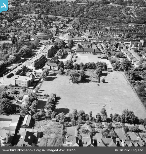
EAW043655 ENGLAND (1952). Upminster Primary School and adjacent playing field, Upminster, 1952
© Copyright OpenStreetMap contributors and licensed by the OpenStreetMap Foundation. 2026. Cartography is licensed as CC BY-SA.
Nearby Images (3)
EAW043655

EAW043656

EAW043657

Details
| Title | [EAW043655] Upminster Primary School and adjacent playing field, Upminster, 1952 |
| Reference | EAW043655 |
| Date | 4-June-1952 |
| Link | |
| Place name | UPMINSTER |
| Parish | |
| District | |
| Country | ENGLAND |
| Easting / Northing | 556057, 186364 |
| Longitude / Latitude | 0.25125874795917, 51.554069443675 |
| National Grid Reference | TQ561864 |
Pins

Matt Aldred edob.mattaldred.com |
Sunday 26th of July 2026 02:11:16 PM | |

GeoffR |
Thursday 15th of January 2015 04:32:59 PM | |
|
GeoffR |
Thursday 15th of January 2015 04:30:11 PM | |
|
GeoffR |
Thursday 15th of January 2015 04:29:32 PM | |
|
GeoffR |
Thursday 15th of January 2015 04:06:54 PM | |
|
GeoffR |
Thursday 15th of January 2015 04:06:13 PM | |
|
GeoffR |
Thursday 15th of January 2015 04:05:44 PM | |
|
GeoffR |
Thursday 15th of January 2015 04:04:48 PM | |
|
GeoffR |
Thursday 15th of January 2015 04:03:07 PM | |
|
GeoffR |
Thursday 15th of January 2015 04:01:47 PM | |
|
GeoffR |
Thursday 15th of January 2015 04:00:50 PM |