
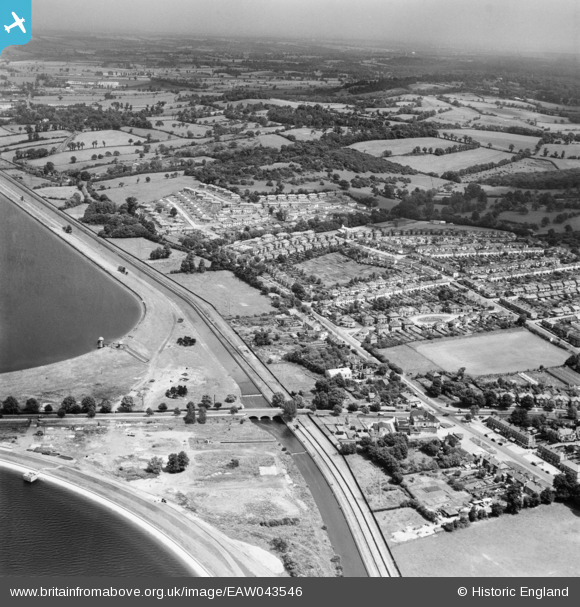
EAW043546 ENGLAND (1952). Housing estate between Lea Valley Road and Yardley Hill, Chingford, from the south-west, 1952
© Copyright OpenStreetMap contributors and licensed by the OpenStreetMap Foundation. 2026. Cartography is licensed as CC BY-SA.
Nearby Images (4)
EAW043546

EPW060221
 Reservoir under construction, Edmonton, from the north-east, 1938")
EAW043545

EPW049522

Details
| Title | [EAW043546] Housing estate between Lea Valley Road and Yardley Hill, Chingford, from the south-west, 1952 |
| Reference | EAW043546 |
| Date | 4-June-1952 |
| Link | |
| Place name | CHINGFORD |
| Parish | |
| District | |
| Country | ENGLAND |
| Easting / Northing | 537506, 194975 |
| Longitude / Latitude | -0.012795546060398, 51.636283798558 |
| National Grid Reference | TQ375950 |
