
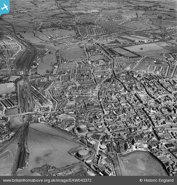
EAW043372 ENGLAND (1952). The town, Northampton, 1952
© Copyright OpenStreetMap contributors and licensed by the OpenStreetMap Foundation. 2026. Cartography is licensed as CC BY-SA.
Nearby Images (5)
EAW043372

EAW043375

EAW043373

EPW034341

EPW034351

Details
| Title | [EAW043372] The town, Northampton, 1952 |
| Reference | EAW043372 |
| Date | 13-May-1952 |
| Link | |
| Place name | NORTHAMPTON |
| Parish | |
| District | |
| Country | ENGLAND |
| Easting / Northing | 475113, 260732 |
| Longitude / Latitude | -0.89986804484378, 52.239248613749 |
| National Grid Reference | SP751607 |
Pins

Matt Aldred edob.mattaldred.com |
Monday 21st of November 2022 04:42:16 PM | |

James |
Tuesday 24th of November 2020 04:20:05 PM | |
|
James |
Tuesday 24th of November 2020 04:13:54 PM | |
|
James |
Tuesday 24th of November 2020 04:12:53 PM | |
|
Post-war prefabs |
Monday 18th of November 2019 03:44:52 PM |