
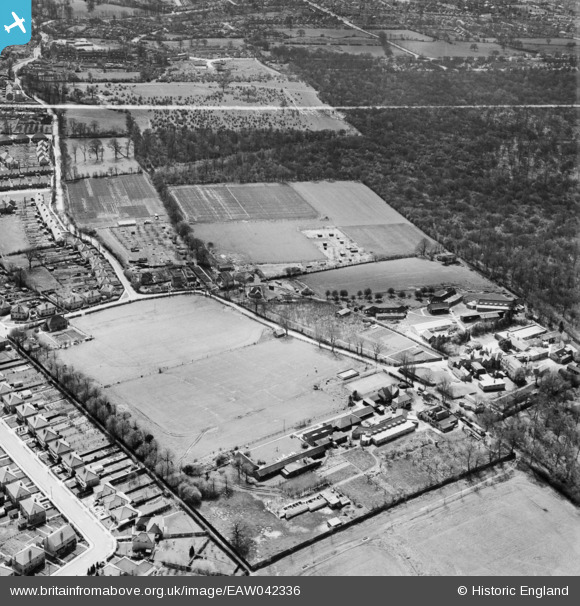
EAW042336 ENGLAND (1952). St Vincent's Orthopaedic Hospital and the surrounding area, Northwood Hills, 1952. This image was marked by Aerofilms Ltd for photo editing.
© Copyright OpenStreetMap contributors and licensed by the OpenStreetMap Foundation. 2025. Cartography is licensed as CC BY-SA.
Nearby Images (12)
EAW042336

EAW042337

EAW042342

EAW042340

EAW042341

EAW042338

EAW042339

EAW042331

EAW042334

EAW042333

EAW042335

EAW042332

Details
| Title | [EAW042336] St Vincent's Orthopaedic Hospital and the surrounding area, Northwood Hills, 1952. This image was marked by Aerofilms Ltd for photo editing. |
| Reference | EAW042336 |
| Date | 11-April-1952 |
| Link | |
| Place name | NORTHWOOD HILLS |
| Parish | |
| District | |
| Country | ENGLAND |
| Easting / Northing | 509664, 189533 |
| Longitude / Latitude | -0.41667829677972, 51.593485163092 |
| National Grid Reference | TQ097895 |
Pins
 The Laird |
Saturday 2nd of May 2015 10:35:53 AM |