
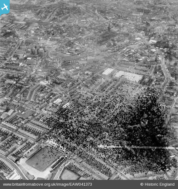
EAW041373 ENGLAND (1951). Singer Motors Ltd Works off Canterbury Street and the city, Coventry, 1951. This image has been produced from a damaged negative.
© Copyright OpenStreetMap contributors and licensed by the OpenStreetMap Foundation. 2026. Cartography is licensed as CC BY-SA.
Nearby Images (40)
EAW041373

EAW041372

EPW044060

EAW041370

EAW041374

EPW044058

EPW044059

EPW044057

EAW041346

EAW041371

EPW044040

EPW044039

EAW041354

EAW041369

EAW041339

EAW041341

EPW044047

EPW044038

EPW044046

EAW041340

EPW044045

EPW061096

EAW041349

EAW041356

EAW041362

EPW044044

EAW041348

EPW061101

EPW044041

EAW041366

EAW041353

EAW041342

EPW044037

EAW041360

EPW044036

EPW044035

EPW044042

EAW041355

EPW053104

EAW041358

Details
| Title | [EAW041373] Singer Motors Ltd Works off Canterbury Street and the city, Coventry, 1951. This image has been produced from a damaged negative. |
| Reference | EAW041373 |
| Date | 20-November-1951 |
| Link | |
| Place name | COVENTRY |
| Parish | |
| District | |
| Country | ENGLAND |
| Easting / Northing | 434299, 279309 |
| Longitude / Latitude | -1.495709205503, 52.410329711279 |
| National Grid Reference | SP343793 |
Pins
Be the first to add a comment to this image!