
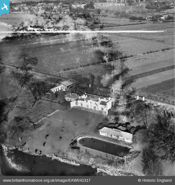
EAW041317 ENGLAND (1951). The Aviary, Norwood Green, 1951. This image has been produced from a damaged negative.
© Copyright OpenStreetMap contributors and licensed by the OpenStreetMap Foundation. 2026. Cartography is licensed as CC BY-SA.
Nearby Images (7)
EAW041317

EAW041321

EAW041319

EAW041322

EAW041320

EAW041323

EAW041318

Details
| Title | [EAW041317] The Aviary, Norwood Green, 1951. This image has been produced from a damaged negative. |
| Reference | EAW041317 |
| Date | 20-November-1951 |
| Link | |
| Place name | NORWOOD GREEN |
| Parish | |
| District | |
| Country | ENGLAND |
| Easting / Northing | 514895, 179039 |
| Longitude / Latitude | -0.344614101571, 51.498115270735 |
| National Grid Reference | TQ149790 |
Pins
Be the first to add a comment to this image!