
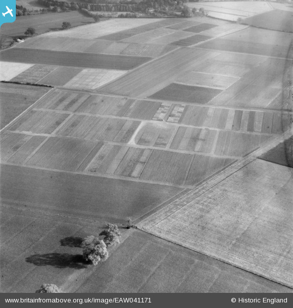
EAW041171 ENGLAND (1951). Cultivated plots at the Rothamsted Experimental Farm, Rothamsted, 1951. This image has been produced from a damaged negative.
© Copyright OpenStreetMap contributors and licensed by the OpenStreetMap Foundation. 2026. Cartography is licensed as CC BY-SA.
Nearby Images (8)
EAW041171

EAW023127

EAW023122

EAW023134

EAW023121

EAW023129

EAW023124

EAW041170

Details
| Title | [EAW041171] Cultivated plots at the Rothamsted Experimental Farm, Rothamsted, 1951. This image has been produced from a damaged negative. |
| Reference | EAW041171 |
| Date | 1-November-1951 |
| Link | |
| Place name | ROTHAMSTED |
| Parish | HARPENDEN RURAL |
| District | |
| Country | ENGLAND |
| Easting / Northing | 511811, 213897 |
| Longitude / Latitude | -0.37787867464176, 51.812061454528 |
| National Grid Reference | TL118139 |
Pins
Be the first to add a comment to this image!