
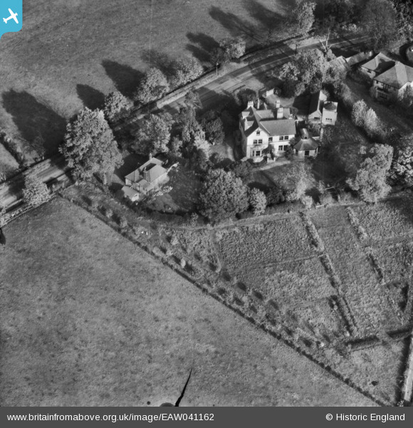
EAW041162 ENGLAND (1951). Palmer's Lodge on Allum Lane, Elstree, 1951. This image has been produced from a damaged negative.
© Copyright OpenStreetMap contributors and licensed by the OpenStreetMap Foundation. 2026. Cartography is licensed as CC BY-SA.
Nearby Images (7)
EAW041162

EAW041161

EAW041160

EAW041159

EAW041163

EAW041164

EAW047985

Details
| Title | [EAW041162] Palmer's Lodge on Allum Lane, Elstree, 1951. This image has been produced from a damaged negative. |
| Reference | EAW041162 |
| Date | 1-November-1951 |
| Link | |
| Place name | ELSTREE |
| Parish | ELSTREE AND BOREHAMWOOD |
| District | |
| Country | ENGLAND |
| Easting / Northing | 518196, 195883 |
| Longitude / Latitude | -0.29140779516942, 51.648835269101 |
| National Grid Reference | TQ182959 |
Pins
Be the first to add a comment to this image!