
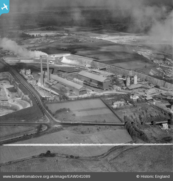
EAW041089 ENGLAND (1951). The Metropolitan and the Aluminous Cement Works, West Thurrock, from the south-west, 1951. This image was marked by Aerofilms Ltd for photo editing.
© Copyright OpenStreetMap contributors and licensed by the OpenStreetMap Foundation. 2026. Cartography is licensed as CC BY-SA.
Nearby Images (42)
EAW041089

EPW026637

EPW026642

EAW041095

EPW026638

EPW027526

EAW020320

EAW041092

EPW061840

EPW061841

EAW021518

EAW021516

EPW061839

EPW061838

EAW021515

EAW021517

EAW002391

EPW061843

EAW041090

EAW002394

EAW041088

EAW002389

EAW041094

EAW021519
, West Thurrock, 1949. This image has been produced from a damaged negative.")
EPW061842

EAW041191

EAW021513

EAW002395

EAW041188

EAW041186

EPW027529

EAW021522

EAW002392

EAW021511

EAW041185

EAW041189

EAW041187

EAW021512

EAW041184

EAW041192

EAW021521

EAW021514

Details
| Title | [EAW041089] The Metropolitan and the Aluminous Cement Works, West Thurrock, from the south-west, 1951. This image was marked by Aerofilms Ltd for photo editing. |
| Reference | EAW041089 |
| Date | 25-October-1951 |
| Link | |
| Place name | WEST THURROCK |
| Parish | |
| District | |
| Country | ENGLAND |
| Easting / Northing | 557142, 177874 |
| Longitude / Latitude | 0.26311211561314, 51.477481758276 |
| National Grid Reference | TQ571779 |
Pins

Dylan Moore |
Sunday 27th of April 2014 12:58:28 PM | |
|
Dylan Moore |
Sunday 27th of April 2014 12:54:40 PM | |
|
Dylan Moore |
Sunday 27th of April 2014 12:46:53 PM | |
|
Dylan Moore |
Sunday 27th of April 2014 12:43:09 PM | |
|
Dylan Moore |
Sunday 27th of April 2014 12:42:44 PM | |
|
Dylan Moore |
Sunday 27th of April 2014 12:27:07 PM |