
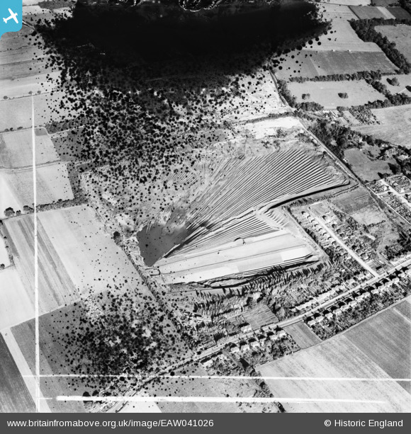
EAW041026 ENGLAND (1951). Clay pit between Sandy Lane and Purfleet Road, Aveley, 1951. This image has been produced from a damaged negative.
© Copyright OpenStreetMap contributors and licensed by the OpenStreetMap Foundation. 2026. Cartography is licensed as CC BY-SA.
Nearby Images (9)
EAW041026

EAW041025

EAW041024

EAW041027

EAW041023

EAW041028

EAW041022

EAW041019

EAW041021

Details
| Title | [EAW041026] Clay pit between Sandy Lane and Purfleet Road, Aveley, 1951. This image has been produced from a damaged negative. |
| Reference | EAW041026 |
| Date | 23-October-1951 |
| Link | |
| Place name | AVELEY |
| Parish | |
| District | |
| Country | ENGLAND |
| Easting / Northing | 555749, 180467 |
| Longitude / Latitude | 0.24421136247092, 51.501166767083 |
| National Grid Reference | TQ557805 |
Pins
Be the first to add a comment to this image!
User Comment Contributions
Tunnel Portland Cement Company Ltd clayfields supplying London Clay pumped as slurry to the West Thurrock cement plant. Opened 1927, closed 1976. At this time processing around 0.5 million tonnes of raw clay per year, later increased to 0.7 million. |

Dylan Moore |
Tuesday 29th of April 2014 09:27:10 AM |