
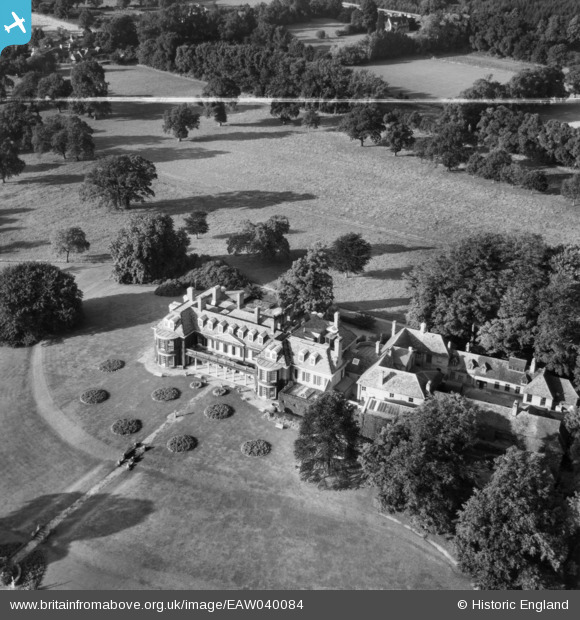
EAW040084 ENGLAND (1951). Fernhill Park, Cranbourne, 1951. This image was marked by Aerofilms Ltd for photo editing.
© Copyright OpenStreetMap contributors and licensed by the OpenStreetMap Foundation. 2026. Cartography is licensed as CC BY-SA.
Nearby Images (3)
EAW040084

EAW040082

EAW040080

Details
| Title | [EAW040084] Fernhill Park, Cranbourne, 1951. This image was marked by Aerofilms Ltd for photo editing. |
| Reference | EAW040084 |
| Date | 21-September-1951 |
| Link | |
| Place name | CRANBOURNE |
| Parish | WINKFIELD |
| District | |
| Country | ENGLAND |
| Easting / Northing | 493196, 172098 |
| Longitude / Latitude | -0.65897716836026, 51.439710236545 |
| National Grid Reference | SU932721 |
Pins
Be the first to add a comment to this image!