
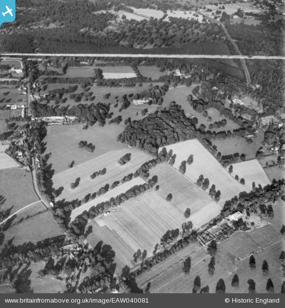
EAW040081 ENGLAND (1951). Fernhill Park and the surrounding area, Cranbourne, 1951. This image has been produced from a copy-negative marked by Aerofilms Ltd for photo editing.
© Copyright OpenStreetMap contributors and licensed by the OpenStreetMap Foundation. 2026. Cartography is licensed as CC BY-SA.
Nearby Images (2)
EAW040081

EAW040080

Details
| Title | [EAW040081] Fernhill Park and the surrounding area, Cranbourne, 1951. This image has been produced from a copy-negative marked by Aerofilms Ltd for photo editing. |
| Reference | EAW040081 |
| Date | 21-September-1951 |
| Link | |
| Place name | CRANBOURNE |
| Parish | WINKFIELD |
| District | |
| Country | ENGLAND |
| Easting / Northing | 492902, 171855 |
| Longitude / Latitude | -0.66327015660457, 51.437573935836 |
| National Grid Reference | SU929719 |
Pins

Bart |
Thursday 11th of May 2023 04:08:43 PM | |
|
Bart |
Thursday 11th of May 2023 04:05:29 PM |