
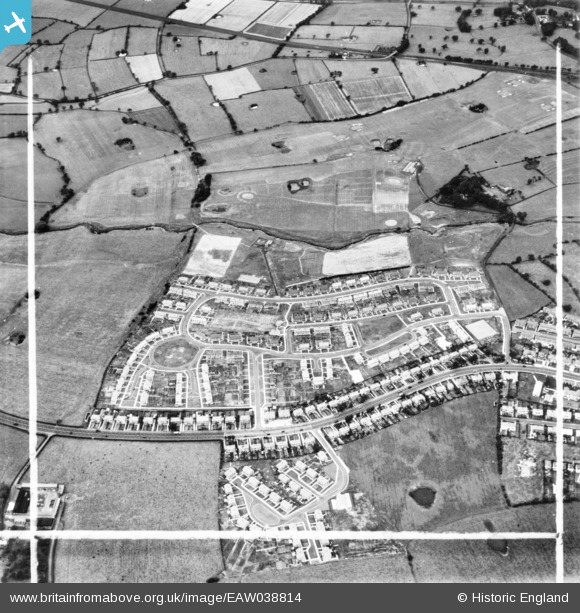
EAW038814 ENGLAND (1951). Housing development off Blackpool Road, Lea, 1951. This image has been produced from a print marked by Aerofilms Ltd for photo editing.
© Copyright OpenStreetMap contributors and licensed by the OpenStreetMap Foundation. 2025. Cartography is licensed as CC BY-SA.
Nearby Images (7)
EAW038814

EAW038818

EAW038813

EAW038819

EAW038817

EAW038815

EAW038820

Details
| Title | [EAW038814] Housing development off Blackpool Road, Lea, 1951. This image has been produced from a print marked by Aerofilms Ltd for photo editing. |
| Reference | EAW038814 |
| Date | 15-August-1951 |
| Link | |
| Place name | LEA |
| Parish | LEA |
| District | |
| Country | ENGLAND |
| Easting / Northing | 349190, 430400 |
| Longitude / Latitude | -2.7709266656048, 53.767246919129 |
| National Grid Reference | SD492304 |
Pins

pictureit |
Saturday 14th of January 2017 01:08:39 PM | |
|
ColMairs |
Sunday 8th of February 2015 01:27:28 PM | |
|
ColMairs |
Sunday 8th of February 2015 01:24:26 PM | |
|
ColMairs |
Sunday 8th of February 2015 01:23:52 PM | |
|
ColMairs |
Sunday 8th of February 2015 01:01:36 PM |