
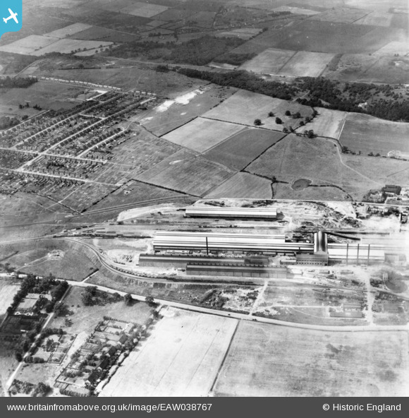
EAW038767 ENGLAND (1951). Part of the John Lysaght Ltd Normanby Park Steel Works, Scunthorpe, 1951. This image has been produced from a print.
© Copyright OpenStreetMap contributors and licensed by the OpenStreetMap Foundation. 2026. Cartography is licensed as CC BY-SA.
Nearby Images (48)
EAW038767

EAW038755

EAW013825

EAW038758

EAW019677

EAW034802

EAW038764

EAW031168

EAW013491

EAW038777

EAW038754

EAW023920

EAW038749

EAW034810

EAW009412

EAW013496

EAW021141
, Scunthorpe, 1949. This image has been produced from a damaged negative.")
EAW038756

EAW013493

EAW019679

EAW019666

EAW027163

EAW041832

EAW021143
, Scunthorpe, 1949. This image has been produced from a damaged negative.")
EAW027167

EAW034817

EAW013492

EAW031169

EAW021127

EAW038759

EAW023922

EAW034827

EAW013826

EAW021126

EAW019664

EAW009413

EAW034807

EAW013494

EAW027169
, Scunthorpe, from the south, 1949. This image has been produced from a damaged negative.")
EAW031170

EAW021129

EAW021130

EAW021125

EAW027170

EAW009414

EAW038753

EAW013830

EAW027171

Details
| Title | [EAW038767] Part of the John Lysaght Ltd Normanby Park Steel Works, Scunthorpe, 1951. This image has been produced from a print. |
| Reference | EAW038767 |
| Date | 15-August-1951 |
| Link | |
| Place name | SCUNTHORPE |
| Parish | |
| District | |
| Country | ENGLAND |
| Easting / Northing | 488858, 413063 |
| Longitude / Latitude | -0.65688689828193, 53.606343369233 |
| National Grid Reference | SE889131 |
Pins
Be the first to add a comment to this image!