
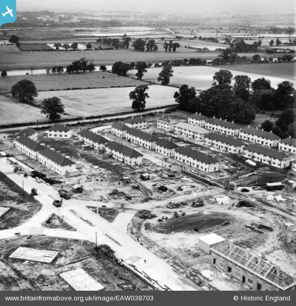
EAW038703 ENGLAND (1951). Housing construction and development around Sturgeon Avenue on the Clifton Estate, Clifton, from the south-east, 1951. This image has been produced from a print.
© Copyright OpenStreetMap contributors and licensed by the OpenStreetMap Foundation. 2026. Cartography is licensed as CC BY-SA.
Nearby Images (18)
EAW038703

EAW038704

EAW038707

EAW038706

EAW038700

EAW038705

EAW038696

EAW048679

EAW038699

EAW038702

EAW038701

EAW038697

EAW038698

EAW048687

EAW048680

EAW048682

EAW048681

EAW048684

Details
| Title | [EAW038703] Housing construction and development around Sturgeon Avenue on the Clifton Estate, Clifton, from the south-east, 1951. This image has been produced from a print. |
| Reference | EAW038703 |
| Date | 14-August-1951 |
| Link | |
| Place name | CLIFTON |
| Parish | |
| District | |
| Country | ENGLAND |
| Easting / Northing | 455595, 335548 |
| Longitude / Latitude | -1.1731400112149, 52.914157489382 |
| National Grid Reference | SK556355 |
Pins

KC |
Saturday 26th of June 2021 08:13:59 PM | |
|
KC |
Saturday 26th of June 2021 08:12:37 PM | |

Billy Turner |
Monday 22nd of May 2017 04:47:10 PM | |
|
Billy Turner |
Monday 22nd of May 2017 04:21:11 PM |

