
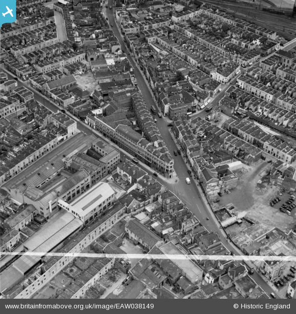
EAW038149 ENGLAND (1951). The junction of Lawrence Hill and Easton Road, Bristol, 1951. This image was marked by Aerofilms Ltd for photo editing.
© Copyright OpenStreetMap contributors and licensed by the OpenStreetMap Foundation. 2026. Cartography is licensed as CC BY-SA.
Nearby Images (11)
EAW038149

EAW038150

EAW038155

EAW038152

EAW038151

EAW038157

EAW038156

EAW038147

EAW038153

EAW038148

EAW038154

Details
| Title | [EAW038149] The junction of Lawrence Hill and Easton Road, Bristol, 1951. This image was marked by Aerofilms Ltd for photo editing. |
| Reference | EAW038149 |
| Date | 25-July-1951 |
| Link | |
| Place name | BRISTOL |
| Parish | |
| District | |
| Country | ENGLAND |
| Easting / Northing | 360258, 173422 |
| Longitude / Latitude | -2.5720762260785, 51.457890662915 |
| National Grid Reference | ST603734 |
