
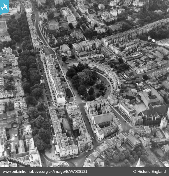
EAW038121 ENGLAND (1951). The Royal Crescent and environs, Cheltenham, 1951. This image has been produced from a print.
© Copyright OpenStreetMap contributors and licensed by the OpenStreetMap Foundation. 2026. Cartography is licensed as CC BY-SA.
Nearby Images (9)
EAW038121

EAW038120

EPW000177

EPW024140

EPW000165

EPW000171

EAW006882

EPW000169

EPW000198

Details
| Title | [EAW038121] The Royal Crescent and environs, Cheltenham, 1951. This image has been produced from a print. |
| Reference | EAW038121 |
| Date | 25-July-1951 |
| Link | |
| Place name | CHELTENHAM |
| Parish | |
| District | |
| Country | ENGLAND |
| Easting / Northing | 394705, 222357 |
| Longitude / Latitude | -2.0769645935066, 51.899295870812 |
| National Grid Reference | SO947224 |
Pins
Be the first to add a comment to this image!