
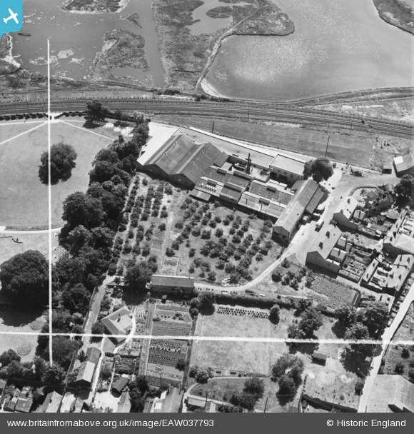
EAW037793 ENGLAND (1951). The Woodbridge Canning Co Ltd Cannery, Woodbridge, 1951. This image was marked by Aerofilms Ltd for photo editing.
© Copyright OpenStreetMap contributors and licensed by the OpenStreetMap Foundation. 2025. Cartography is licensed as CC BY-SA.
Nearby Images (8)
EAW037793

EAW037794

EAW037792

EAW037788

EAW037787

EAW037790

EAW037791

EAW037789

Details
| Title | [EAW037793] The Woodbridge Canning Co Ltd Cannery, Woodbridge, 1951. This image was marked by Aerofilms Ltd for photo editing. |
| Reference | EAW037793 |
| Date | 17-July-1951 |
| Link | |
| Place name | WOODBRIDGE |
| Parish | WOODBRIDGE |
| District | |
| Country | ENGLAND |
| Easting / Northing | 627602, 249018 |
| Longitude / Latitude | 1.3229753921204, 52.092202501538 |
| National Grid Reference | TM276490 |
Pins
Be the first to add a comment to this image!