
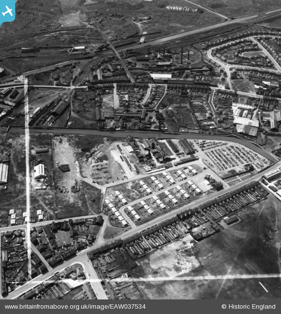
EAW037534 ENGLAND (1951). Balls Hill Branch Canal, prefabricated houses on Belper Road and environs West Bromwich, 1951. This image has been produced from a print marked by Aerofilms Ltd for photo editing.
© Copyright OpenStreetMap contributors and licensed by the OpenStreetMap Foundation. 2026. Cartography is licensed as CC BY-SA.
Nearby Images (19)
EAW037534

EAW037542

EAW037533

EAW037539

EAW037538

EAW037537

EAW037536

EAW037535

EPW046429

EPW046428

EPW046427

EPW046424

EPW046425

EPW046426

EPW046066

EPW046067

EPW046065

EPW046062

EPW046063

Details
| Title | [EAW037534] Balls Hill Branch Canal, prefabricated houses on Belper Road and environs West Bromwich, 1951. This image has been produced from a print marked by Aerofilms Ltd for photo editing. |
| Reference | EAW037534 |
| Date | 1-July-1951 |
| Link | |
| Place name | WEST BROMWICH |
| Parish | |
| District | |
| Country | ENGLAND |
| Easting / Northing | 398792, 291226 |
| Longitude / Latitude | -2.0178045126928, 52.518549889144 |
| National Grid Reference | SO988912 |
