
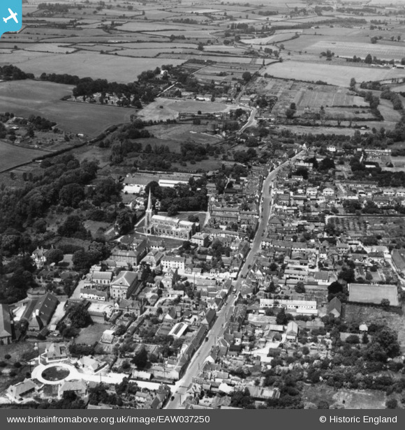
EAW037250 ENGLAND (1951). St Mary's Church and the High Street, Hadleigh, 1951. This image has been produced from a print.
© Copyright OpenStreetMap contributors and licensed by the OpenStreetMap Foundation. 2026. Cartography is licensed as CC BY-SA.
Nearby Images (6)
EAW037250

EAW037251

EAW037252

EAW033336

EAW033337

EAW033335

Details
| Title | [EAW037250] St Mary's Church and the High Street, Hadleigh, 1951. This image has been produced from a print. |
| Reference | EAW037250 |
| Date | 21-June-1951 |
| Link | |
| Place name | HADLEIGH |
| Parish | HADLEIGH |
| District | |
| Country | ENGLAND |
| Easting / Northing | 602547, 242543 |
| Longitude / Latitude | 0.9538909422402, 52.043797416956 |
| National Grid Reference | TM025425 |
Pins
Be the first to add a comment to this image!