
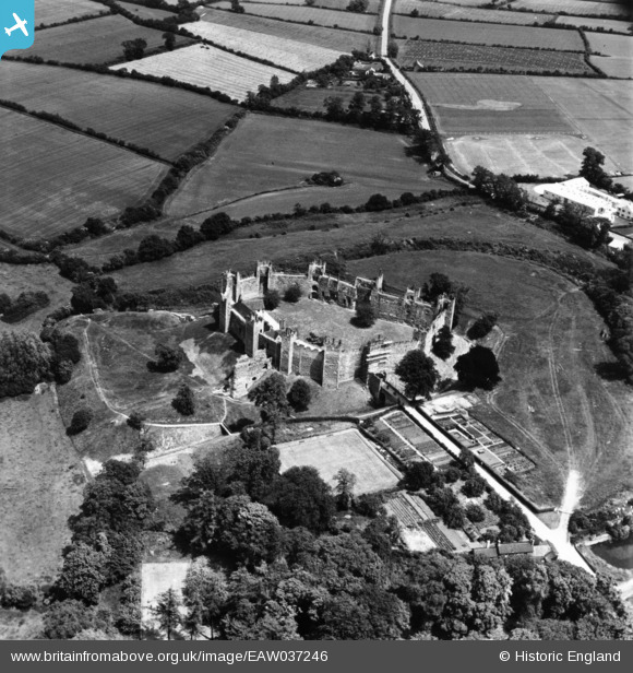
EAW037246 ENGLAND (1951). Framlingham Castle, Framlingham, 1951. This image has been produced from a print.
© Copyright OpenStreetMap contributors and licensed by the OpenStreetMap Foundation. 2026. Cartography is licensed as CC BY-SA.
Nearby Images (22)
EAW037246

EAW008408

EAW008406

EAW008411

EAW008410

EAW008413

EAW014015

EAW008407

EAW014019

EAW030401

EAW008412

EAW014016

EAW030402

EAW014018

EAW014014

EAW014017

EAW008409

EAW037245

EAW014020

EAW014013

EAW037247

EAW030400

Details
| Title | [EAW037246] Framlingham Castle, Framlingham, 1951. This image has been produced from a print. |
| Reference | EAW037246 |
| Date | 21-June-1951 |
| Link | |
| Place name | FRAMLINGHAM |
| Parish | FRAMLINGHAM |
| District | |
| Country | ENGLAND |
| Easting / Northing | 628680, 263736 |
| Longitude / Latitude | 1.3485957335904, 52.223869551363 |
| National Grid Reference | TM287637 |
Pins

Matt Aldred edob.mattaldred.com |
Thursday 26th of November 2020 09:20:30 PM | |

redmist |
Saturday 3rd of October 2020 04:31:17 PM |