
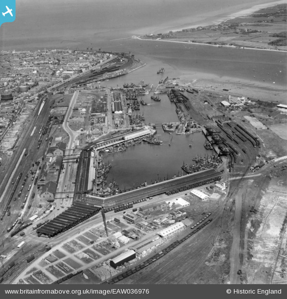
EAW036976 ENGLAND (1951). The docks and harbour, Fleetwood, 1951. This image has been produced from a print.
© Copyright OpenStreetMap contributors and licensed by the OpenStreetMap Foundation. 2026. Cartography is licensed as CC BY-SA.
Nearby Images (15)
EAW036976

EPW038907

EPW038906

EPW038909

EPW038908

EPW038730

EPW038729

EPW038738

EPW038728

EAW023417

EPW038726

EPW038725

EPW038724

EPW003038

EPW038727

Details
| Title | [EAW036976] The docks and harbour, Fleetwood, 1951. This image has been produced from a print. |
| Reference | EAW036976 |
| Date | 7-June-1951 |
| Link | |
| Place name | FLEETWOOD |
| Parish | FLEETWOOD |
| District | |
| Country | ENGLAND |
| Easting / Northing | 333448, 447015 |
| Longitude / Latitude | -3.013339221245, 53.914801436611 |
| National Grid Reference | SD334470 |
Pins

Matt Aldred edob.mattaldred.com |
Sunday 3rd of May 2026 07:30:43 PM | |

redmist |
Wednesday 10th of February 2021 08:13:25 PM | |
|
redmist |
Wednesday 10th of February 2021 08:12:18 PM |