
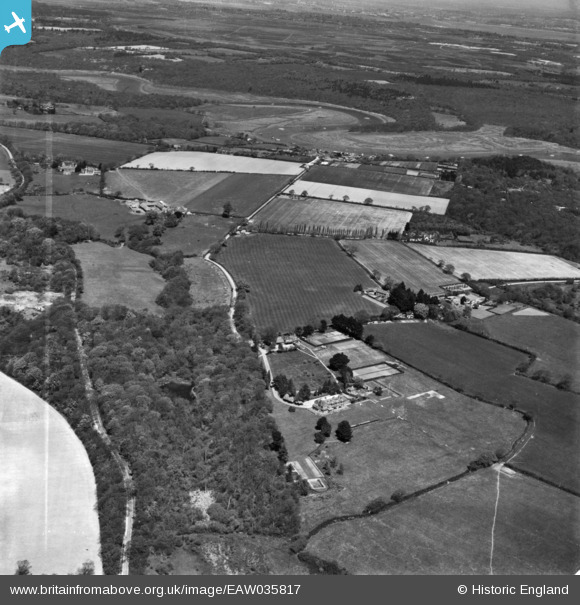
EAW035817 ENGLAND (1951). Drokes and the surrounding countryside, Bucklers Hard, from the south, 1951. This image has been produced from a print marked by Aerofilms Ltd for photo editing.
© Copyright OpenStreetMap contributors and licensed by the OpenStreetMap Foundation. 2025. Cartography is licensed as CC BY-SA.
Nearby Images (6)
EAW035817

EAW035814

EAW035815

EAW035816

EAW035813

EAW035818

Details
| Title | [EAW035817] Drokes and the surrounding countryside, Bucklers Hard, from the south, 1951. This image has been produced from a print marked by Aerofilms Ltd for photo editing. |
| Reference | EAW035817 |
| Date | 12-May-1951 |
| Link | |
| Place name | BUCKLERS HARD |
| Parish | BEAULIEU |
| District | |
| Country | ENGLAND |
| Easting / Northing | 440748, 98799 |
| Longitude / Latitude | -1.4218809068784, 50.78676257598 |
| National Grid Reference | SZ407988 |
Pins
Be the first to add a comment to this image!