
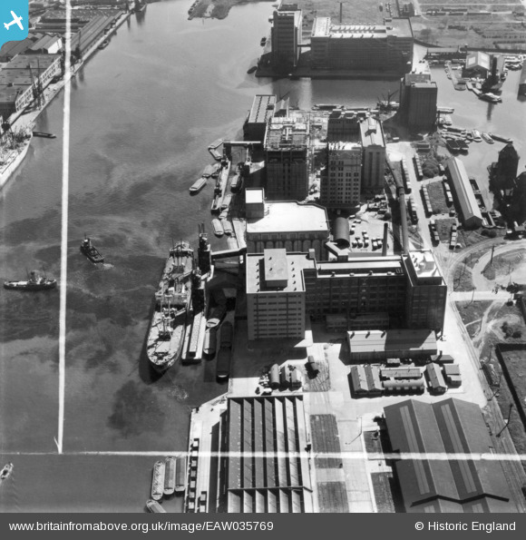
EAW035769 ENGLAND (1951). The Joseph Rank Ltd Empire Mill at Royal Victoria Dock and environs, Silvertown, 1951. This image has been produced from a print marked by Aerofilms Ltd for photo editing.
© Copyright OpenStreetMap contributors and licensed by the OpenStreetMap Foundation. 2026. Cartography is licensed as CC BY-SA.
Nearby Images (36)
EAW035769

EAW035971

EAW035973

EAW035975

EPW046153

EAW035974

EAW035970

EAW035969

EAW035768

EAW035770

EPW055308

EAW035766

EAW035765

EAW035767

EAW035972

EAW008822

EPW053025

EPW053026

EPW053056

EAW021715

EPW053180

EPW053181

EAW021714

EPW053182

EPW053179

EPW059357A

EPW053023

EAW016656

EPW008883

EAW035771

EAW035962

EAW035762

EPW032932

EAW015525
, Silvertown, 1948. This image has been produced from a damaged negative.")
EPR000001

EAW015524
, Silvertown, 1948. This image has been produced from a damaged negative.")
Details
| Title | [EAW035769] The Joseph Rank Ltd Empire Mill at Royal Victoria Dock and environs, Silvertown, 1951. This image has been produced from a print marked by Aerofilms Ltd for photo editing. |
| Reference | EAW035769 |
| Date | 12-May-1951 |
| Link | |
| Place name | SILVERTOWN |
| Parish | |
| District | |
| Country | ENGLAND |
| Easting / Northing | 540831, 180439 |
| Longitude / Latitude | 0.029397124365355, 51.504829828998 |
| National Grid Reference | TQ408804 |
Pins

Class31 |
Saturday 28th of February 2015 08:37:29 AM |