
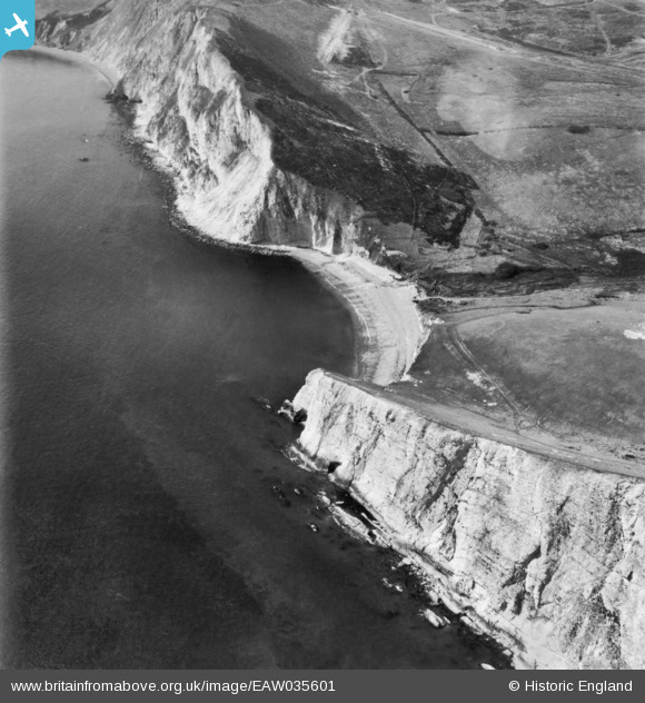
EAW035601 ENGLAND (1951). Arish Mell, East Lulworth, 1951. This image has been produced from a print.
© Copyright OpenStreetMap contributors and licensed by the OpenStreetMap Foundation. 2026. Cartography is licensed as CC BY-SA.
Details
| Title | [EAW035601] Arish Mell, East Lulworth, 1951. This image has been produced from a print. |
| Reference | EAW035601 |
| Date | 25-April-1951 |
| Link | |
| Place name | EAST LULWORTH |
| Parish | EAST LULWORTH |
| District | |
| Country | ENGLAND |
| Easting / Northing | 385512, 80237 |
| Longitude / Latitude | -2.20482721229, 50.621073394335 |
| National Grid Reference | SY855802 |
Pins

cptpies |
Friday 21st of November 2014 02:19:44 PM |
User Comment Contributions

AT Blocks at Arish Mell. |
cptpies |
Friday 21st of November 2014 02:21:04 PM |