
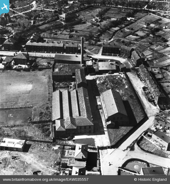
EAW035557 ENGLAND (1951). Longfield Shoddy Mills, Heckmondwike, 1951. This image has been produced from a print.
© Copyright OpenStreetMap contributors and licensed by the OpenStreetMap Foundation. 2025. Cartography is licensed as CC BY-SA.
Nearby Images (10)
EAW035557

EAW035563

EAW035558

EAW035564

EAW035559

EAW035562

EAW035556

EAW035560

EAW035555

EAW035561

Details
| Title | [EAW035557] Longfield Shoddy Mills, Heckmondwike, 1951. This image has been produced from a print. |
| Reference | EAW035557 |
| Date | 21-April-1951 |
| Link | |
| Place name | HECKMONDWIKE |
| Parish | |
| District | |
| Country | ENGLAND |
| Easting / Northing | 422019, 423989 |
| Longitude / Latitude | -1.6663547853121, 53.711631872449 |
| National Grid Reference | SE220240 |
