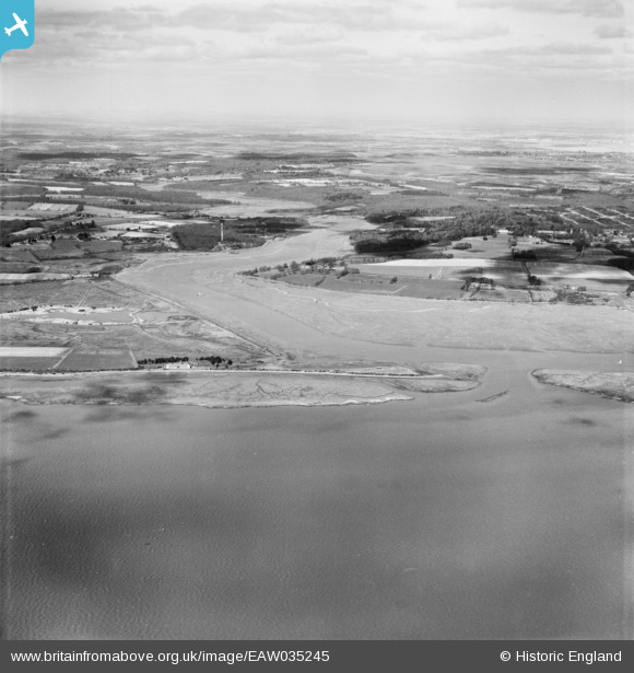
EAW035245 ENGLAND (1951). The Beaulieu River, Needs Ore Point, from the south-east, 1951
© Copyright OpenStreetMap contributors and licensed by the OpenStreetMap Foundation. 2026. Cartography is licensed as CC BY-SA.
Nearby Images (2)
EAW035245

EAW035246
, Needs Ore Point, from the south-east, 1951. This image has been produced from a damaged negative.")
Details
| Title | [EAW035245] The Beaulieu River, Needs Ore Point, from the south-east, 1951 |
| Reference | EAW035245 |
| Date | 6-April-1951 |
| Link | |
| Place name | NEEDS ORE POINT |
| Parish | BEAULIEU |
| District | |
| Country | ENGLAND |
| Easting / Northing | 442964, 97173 |
| Longitude / Latitude | -1.3906329577337, 50.771979741747 |
| National Grid Reference | SZ430972 |
Pins

Class31 |
Sunday 19th of October 2014 08:27:17 PM |