
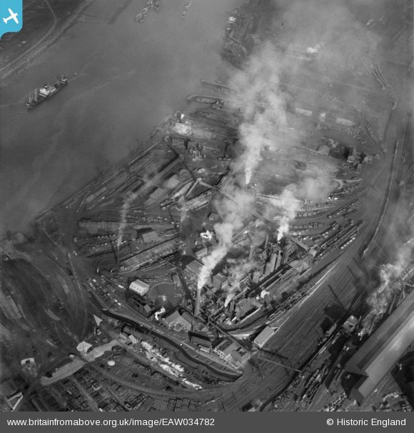
EAW034782 ENGLAND (1951). The Normanby Iron Works, Middlesbrough, 1951
© Copyright OpenStreetMap contributors and licensed by the OpenStreetMap Foundation. 2026. Cartography is licensed as CC BY-SA.
Nearby Images (19)
EAW034782

EAW034793

EAW034787

EAW034785

EAW034789

EAW034784

EAW034792

EAW034791

EAW034788

EAW034786

EAW034795

EAW034790

EAW034796

EAW034794

EAW034781

EAW034783

EAW007967

EPW055925

EPW055916

Details
| Title | [EAW034782] The Normanby Iron Works, Middlesbrough, 1951 |
| Reference | EAW034782 |
| Date | 28-February-1951 |
| Link | |
| Place name | MIDDLESBROUGH |
| Parish | |
| District | |
| Country | ENGLAND |
| Easting / Northing | 451844, 520813 |
| Longitude / Latitude | -1.1978147158941, 54.579739627032 |
| National Grid Reference | NZ518208 |
Pins
Be the first to add a comment to this image!