
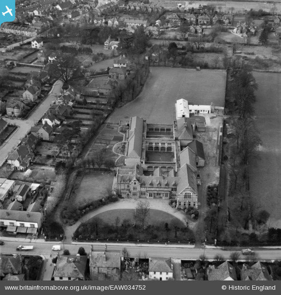
EAW034752 ENGLAND (1951). King Edward VI Grammar School, Chelmsford, 1951
© Copyright OpenStreetMap contributors and licensed by the OpenStreetMap Foundation. 2026. Cartography is licensed as CC BY-SA.
Nearby Images (10)
EAW034752

EAW034750

EAW034753

EAW034755

EAW034751

EAW034757

EAW034754

EAW034756

EAW050571

EPW002000

Details
| Title | [EAW034752] King Edward VI Grammar School, Chelmsford, 1951 |
| Reference | EAW034752 |
| Date | 22-February-1951 |
| Link | |
| Place name | CHELMSFORD |
| Parish | |
| District | |
| Country | ENGLAND |
| Easting / Northing | 570320, 207423 |
| Longitude / Latitude | 0.46707303764818, 51.739137143824 |
| National Grid Reference | TL703074 |
