
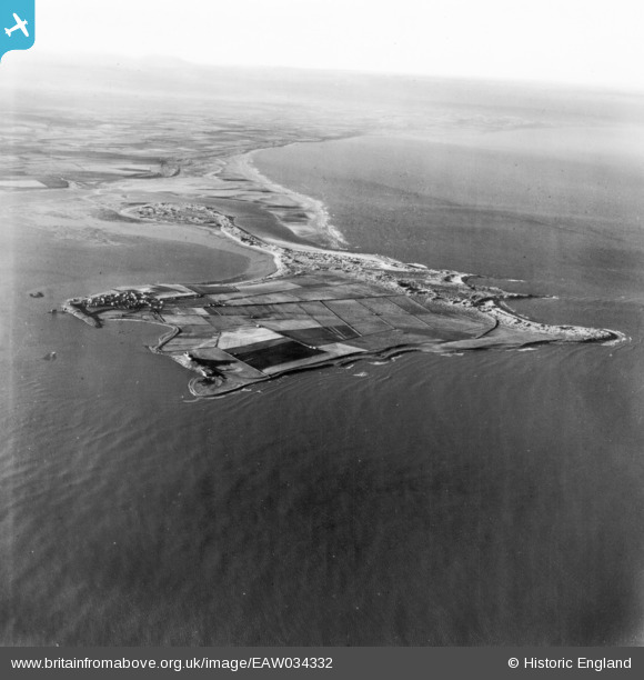
EAW034332 ENGLAND (1950). Holy Island, Holy Island, from the east, 1950. This image has been produced from a print.
© Copyright OpenStreetMap contributors and licensed by the OpenStreetMap Foundation. 2025. Cartography is licensed as CC BY-SA.
Nearby Images (2)
EAW034332

EAW034331

Details
| Title | [EAW034332] Holy Island, Holy Island, from the east, 1950. This image has been produced from a print. |
| Reference | EAW034332 |
| Date | 25-November-1950 |
| Link | |
| Place name | HOLY ISLAND |
| Parish | HOLY ISLAND |
| District | |
| Country | ENGLAND |
| Easting / Northing | 414547, 642004 |
| Longitude / Latitude | -1.7686910661046, 55.671327435712 |
| National Grid Reference | NU145420 |
Pins

Matt Aldred edob.mattaldred.com |
Thursday 31st of December 2020 03:30:34 PM |