
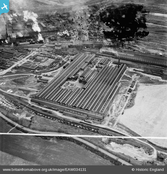
EAW034131 ENGLAND (1950). Stewarts and Lloyds Ltd Iron & Steel Works, Corby, 1950. This image has been produced from a damaged negative.
© Copyright OpenStreetMap contributors and licensed by the OpenStreetMap Foundation. 2026. Cartography is licensed as CC BY-SA.
Nearby Images (19)
EAW034131

EAW034128

EAW034124

EPW054924

EAW034127

EAW034133

EAW034125

EAW034134

EAW034130

EAW034126

EAW034132

EPW049768

EAW045561

EAW034129

EAW034135

EPW049769

EAW034122

EAW044698

EAW045577

Details
| Title | [EAW034131] Stewarts and Lloyds Ltd Iron & Steel Works, Corby, 1950. This image has been produced from a damaged negative. |
| Reference | EAW034131 |
| Date | 26-October-1950 |
| Link | |
| Place name | CORBY |
| Parish | |
| District | |
| Country | ENGLAND |
| Easting / Northing | 490507, 289423 |
| Longitude / Latitude | -0.66671917430233, 52.494828984754 |
| National Grid Reference | SP905894 |
Pins
Be the first to add a comment to this image!