
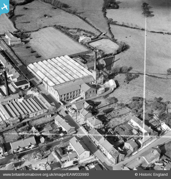
EAW033980 ENGLAND (1950). The Ribblesdale Mill, Ribchester, 1950. This image was marked by Aerofilms Ltd for photo editing.
© Copyright OpenStreetMap contributors and licensed by the OpenStreetMap Foundation. 2026. Cartography is licensed as CC BY-SA.
Nearby Images (8)
EAW033980

EAW033974

EAW033975

EAW033976

EAW033979

EAW033978

EAW033981

EAW033977

Details
| Title | [EAW033980] The Ribblesdale Mill, Ribchester, 1950. This image was marked by Aerofilms Ltd for photo editing. |
| Reference | EAW033980 |
| Date | 14-October-1950 |
| Link | |
| Place name | RIBCHESTER |
| Parish | RIBCHESTER |
| District | |
| Country | ENGLAND |
| Easting / Northing | 364899, 435422 |
| Longitude / Latitude | -2.5331641623163, 53.813683505585 |
| National Grid Reference | SD649354 |
Pins

Matt Aldred edob.mattaldred.com |
Friday 8th of March 2024 06:26:45 PM |