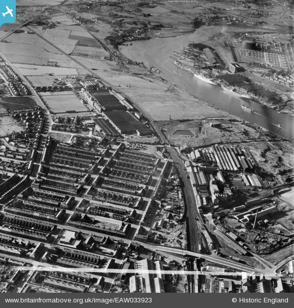
EAW033923 ENGLAND (1950). Hebburn New Town, the Reyrolle Electrical Engineering Works and environs, Hebburn, 1950. This image was marked by Aerofilms Ltd for photo editing.
    © Copyright OpenStreetMap contributors and licensed by the OpenStreetMap Foundation. 2025. Cartography is licensed as CC BY-SA.
  
Nearby Images (8)
Details
| Title | [EAW033923] Hebburn New Town, the Reyrolle Electrical Engineering Works and environs, Hebburn, 1950. This image was marked by Aerofilms Ltd for photo editing. | 
| Reference | EAW033923 | 
| Date | 19-October-1950 | 
| Link | |
| Place name | HEBBURN | 
| Parish | |
| District | |
| Country | ENGLAND | 
| Easting / Northing | 430488, 564205 | 
| Longitude / Latitude | -1.5236808178496, 54.971453029648 | 
| National Grid Reference | NZ305642 | 
Pins
|   N Dunn | Friday 5th of May 2017 10:29:40 AM | |
|  Glen St Methodist Chapel on the corner of Thistle St. |   N Dunn | Friday 5th of May 2017 10:27:07 AM | 
|  Tweed Street which stretched from Hedgeley Road, over Whickham Road & ended at Victoria Road East. |   N Dunn | Sunday 2nd of October 2016 11:33:19 AM | 
|  The Masonic Hall on Aln St/Whickham Rd corner |   N Dunn | Sunday 2nd of October 2016 11:31:33 AM | 
|  Aln St |   N Dunn | Sunday 2nd of October 2016 11:30:11 AM | 
|  In the mid 50s work began to build a Cinema on this land. The Cinema was the 'Rex'. Later it became a Bingo Hall then demolished. Today a Care Home stands on the land. |   N Dunn | Sunday 2nd of October 2016 11:27:32 AM | 
|  This is the Ambulance Station on the corner of St Johns Tce/Victoria Rd West. As they had a large hall attached it was used to hold functions including regular Dances. |   N Dunn | Sunday 2nd of October 2016 11:24:49 AM | 
|  This was the Argyle Hotel on John St /Victoria Rd West and unfortunately was demolished by the Local Authority in 2016 |   N Dunn | Sunday 2nd of October 2016 11:21:34 AM | 
|  These were the Wailes Dove Bitumastic Offices facing onto Hedgeley Rd. Behind the offices is their factory alongside the electrified South Shields to Newcastle railway line (Now the Metro Line) |   N Dunn | Sunday 2nd of October 2016 11:08:50 AM | 
|  This was a Petrol Station/Garage on Victoria Rd West  called Rounthwaites in the 1950s. |   N Dunn | Sunday 2nd of October 2016 11:04:29 AM | 
|  North Drive which was the entrance road to Reyrolles. |   N Dunn | Sunday 2nd of October 2016 11:01:36 AM | 
|  The remains of the Tharsis Sulpher & Copper works. As a little lad I played in these buildings known to us kids as the nickname 'The White House' probably because they were made from concrete. |   N Dunn | Wednesday 18th of June 2014 08:08:46 AM | 
|   N Dunn | Monday 26th of May 2014 09:58:01 AM | |
|   N Dunn | Monday 26th of May 2014 09:56:25 AM | |
|  A travelling Funfair which just happened to be in Hebburn on the day this photo was taken. |   N Dunn | Monday 26th of May 2014 09:52:54 AM | 
|  The Newtown Club.My photo from my www.oldtyneside.co.uk website shows the Club boarded up with its future uncertain. |   N Dunn | Monday 26th of May 2014 09:51:52 AM | 
|  This was Davisons Farm at Bill Quay across the road from the school. My photo from my www.gatesheadeast.co.uk website shows the farm buildings in the background of the school photo. |   N Dunn | Monday 26th of May 2014 09:48:19 AM | 
|  Shortly after this 1950 photo was taken, this land was turned into Allotments which are still there today. As a young lad in the later 1950s my mates & I had an allotment here where we kept pigeons. |   N Dunn | Monday 26th of May 2014 09:43:35 AM | 
|  The Cricketer's Public House in Bill Quay. Photo from my www.gatesheadeast.co.uk website |   N Dunn | Thursday 22nd of May 2014 02:11:58 PM | 
|  Pelaw Stores which belonged to the Co-operative. Most of the south side of Shields Rd in Pelaw, was taken up by various Co-op departments. For example the Dry Saltery, Shirt Factory, Cabinet Works etc, Why not learn about this from my www.gatesheadeast.co.uk website. |   N Dunn | Thursday 22nd of May 2014 02:09:15 PM | 
|  Bluehouse Farm in Hebburn |   N Dunn | Thursday 22nd of May 2014 02:05:19 PM | 
|  Bill Quay School |   N Dunn | Thursday 22nd of May 2014 02:03:35 PM | 
|  The 'Albion' Public House at Bill Quay |   N Dunn | Thursday 22nd of May 2014 02:02:05 PM | 
|  Primrose Cottage , close to where the Deans Primrose Staith was previously |   N Dunn | Thursday 22nd of May 2014 02:00:59 PM | 
|  The Bushing Company on South View adjacent to Reyrolles. |   N Dunn | Thursday 22nd of May 2014 01:58:12 PM | 
|  This was the Council Yard beside the Station Bridge. It was bombed in WW2 & quite a few people were killed |   N Dunn | Tuesday 6th of May 2014 03:39:24 PM | 
|  Glen Street |   N Dunn | Tuesday 6th of May 2014 03:36:45 PM | 
|  Whickham Road |   N Dunn | Tuesday 6th of May 2014 03:34:52 PM | 
|  Hedgeley Rd junction with Station Rd. Locally it was 'Craig's Corner' as the corner shop belonged to Craig the Decorators. |   N Dunn | Tuesday 6th of May 2014 03:34:01 PM | 
|  This area was known locally as 'The Bauxite'. Not a lot is recorded about this 'British Aluminium Co' apart from it produced Aluminium Hydroxide from the ore known as 'Bauxite'. A lot of waste known as red mud was a by-product of the process & it was dumped on the site producing hillocks/mounds of this red mud. It was fenced off to keep people off it. |   N Dunn | Sunday 4th of May 2014 10:45:11 AM | 
|  Main entrance to Hebburn Cemetery on Victoria Rd West |   N Dunn | Saturday 26th of April 2014 09:19:25 AM | 
|  The Newtown School which was sandwiched between Hedgeley Road & Whickham Rd & Aln St & Station Rd |   N Dunn | Saturday 26th of April 2014 09:17:37 AM | 
|  Pelaw Main Coal Staiths. I remember going there as a little lad about 1950-51 & seeing ships being filled with coal with 'Danzig' on the Stern. |   N Dunn | Saturday 26th of April 2014 09:15:10 AM | 
|  Harrison's Shipyard at Bill Quay |   N Dunn | Saturday 26th of April 2014 09:12:39 AM | 
|  'Top Reyrolles' or Reyrolles Newtown Works |   N Dunn | Saturday 26th of April 2014 09:11:47 AM | 
|  This was locally known as 'Bottom Reyrolles' |   N Dunn | Saturday 26th of April 2014 09:10:57 AM | 
|  Buchanan St |   N Dunn | Saturday 26th of April 2014 09:10:00 AM | 
|  St Rollox St |   N Dunn | Saturday 26th of April 2014 09:09:19 AM | 
|  Shamrock St |   N Dunn | Saturday 26th of April 2014 09:08:34 AM | 
|  Rose St |   N Dunn | Saturday 26th of April 2014 09:08:03 AM | 
|  John St in Hebburn 'Newtown' |   N Dunn | Saturday 26th of April 2014 09:06:06 AM | 
|  Charles St. The gap where houses once were is where a bomb hit them during WW2 |   N Dunn | Saturday 26th of April 2014 09:05:11 AM | 
|  Victoria Rd West |   N Dunn | Saturday 26th of April 2014 09:02:04 AM | 
|  Tennant St |   N Dunn | Saturday 26th of April 2014 09:01:39 AM | 
|  Hebburn Railway Station |   N Dunn | Saturday 26th of April 2014 09:00:52 AM | 
|  Lloyds Bank with St Aloysius prefab classrooms adjacent to it. |   N Dunn | Saturday 26th of April 2014 08:59:53 AM | 
|  The Station Hotel on Glen St - Station Rd corner. It was known locally as 'Roys' |   N Dunn | Saturday 26th of April 2014 08:58:20 AM | 
|  The 'Bushing Company' buildings off South Drive |   N Dunn | Saturday 26th of April 2014 08:57:06 AM | 
|  South Drive |   N Dunn | Saturday 26th of April 2014 08:56:17 AM | 
|  Reyrolles Sports Field |   N Dunn | Saturday 26th of April 2014 08:55:29 AM | 
|  Walker Naval Yard |   N Dunn | Saturday 26th of April 2014 08:54:19 AM | 
|  The Reservoir belonging to Tharsis Sulpher & Copper Works which when this photo was taken had closed down. Around this time (1950) a young lad called Colqhoun drowned in this reservoir which had been left unfenced, dangerous & deep. |   N Dunn | Saturday 26th of April 2014 08:53:27 AM | 
 
             
  ![[EAW033923] Hebburn New Town, the Reyrolle Electrical Engineering Works and environs, Hebburn, 1950. This image was marked by Aerofilms Ltd for photo editing.](http://britainfromabove.org.uk/sites/all/libraries/aerofilms-images/public/100x100/EAW/033/EAW033923.jpg) 
  
                                          ![[EPW014020] The Reyrolle Works, Hebburn Cemetery and environs, Hebburn, 1925](http://britainfromabove.org.uk/sites/all/libraries/aerofilms-images/public/100x100/EPW/014/EPW014020.jpg) 
 ![[EPW053948] Hebburn New Town and the Tyne Sulphur and Copper Works, Hebburn, 1937. This image has been produced from a damaged negative.](http://britainfromabove.org.uk/sites/all/libraries/aerofilms-images/public/100x100/EPW/053/EPW053948.jpg) 
 ![[EAW033926] Hebburn New Town, the Reyrolle Electrical Engineering Works and environs, Hebburn, 1950. This image was marked by Aerofilms Ltd for photo editing.](http://britainfromabove.org.uk/sites/all/libraries/aerofilms-images/public/100x100/EAW/033/EAW033926.jpg) 
 ![[EPW019892] The Tyne Sulphur and Copper Works, Hebburn, 1927](http://britainfromabove.org.uk/sites/all/libraries/aerofilms-images/public/100x100/EPW/019/EPW019892.jpg) 
 ![[EAW033927] The Reyrolle Electrical Engineering Works and environs, Hebburn, 1950. This image was marked by Aerofilms Ltd for photo editing.](http://britainfromabove.org.uk/sites/all/libraries/aerofilms-images/public/100x100/EAW/033/EAW033927.jpg) 
 ![[EPW013979] The Reyrolle Works, Hebburn, 1925](http://britainfromabove.org.uk/sites/all/libraries/aerofilms-images/public/100x100/EPW/013/EPW013979.jpg) 
 ![[EPW013980] The Reyrolle Works, Hebburn, 1925](http://britainfromabove.org.uk/sites/all/libraries/aerofilms-images/public/100x100/EPW/013/EPW013980.jpg) 


