
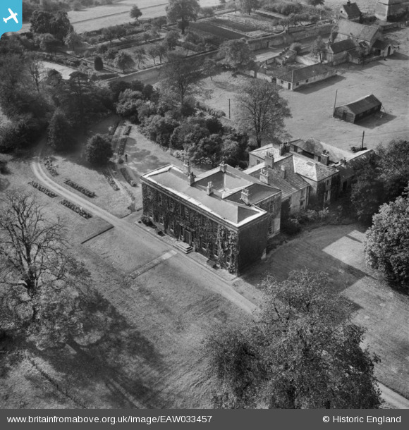
EAW033457 ENGLAND (1950). Loversall Hall, Loversall, 1950
© Copyright OpenStreetMap contributors and licensed by the OpenStreetMap Foundation. 2026. Cartography is licensed as CC BY-SA.
Nearby Images (7)
EAW033457

EAW033458

EAW033459

EAW049176

EAW049175

EAW033456

EAW049177

Details
| Title | [EAW033457] Loversall Hall, Loversall, 1950 |
| Reference | EAW033457 |
| Date | 12-October-1950 |
| Link | |
| Place name | LOVERSALL |
| Parish | LOVERSALL |
| District | |
| Country | ENGLAND |
| Easting / Northing | 457637, 398602 |
| Longitude / Latitude | -1.1313901154649, 53.48072827614 |
| National Grid Reference | SK576986 |
Pins
Be the first to add a comment to this image!