
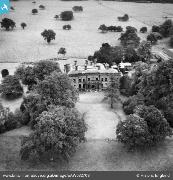
EAW032708 ENGLAND (1950). Booths Hall, Knutsford, 1950
© Copyright OpenStreetMap contributors and licensed by the OpenStreetMap Foundation. 2025. Cartography is licensed as CC BY-SA.
Nearby Images (6)
EAW032708

EAW032705

EAW032709

EAW032707

EAW032706

EAW032710

Details
| Title | [EAW032708] Booths Hall, Knutsford, 1950 |
| Reference | EAW032708 |
| Date | 16-September-1950 |
| Link | |
| Place name | KNUTSFORD |
| Parish | KNUTSFORD |
| District | |
| Country | ENGLAND |
| Easting / Northing | 376660, 377977 |
| Longitude / Latitude | -2.3502353283855, 53.29795949067 |
| National Grid Reference | SJ767780 |
Pins

totoro |
Wednesday 30th of April 2014 07:37:41 PM |