
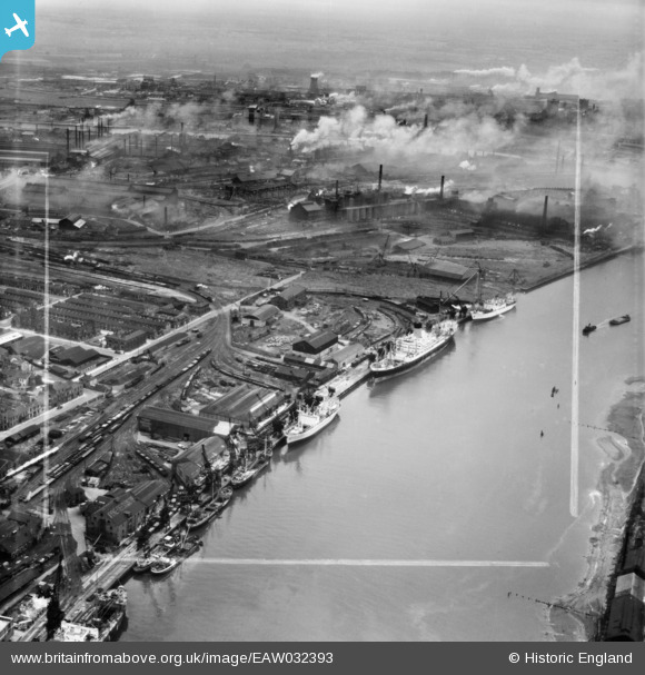
EAW032393 ENGLAND (1950). Dent's Wharf and environs, Middlesbrough, 1950. This image was marked by Aerofilms Ltd for photo editing.
© Copyright OpenStreetMap contributors and licensed by the OpenStreetMap Foundation. 2026. Cartography is licensed as CC BY-SA.
Nearby Images (11)
EAW032393

EAW032396

EAW032388

EAW032391

EAW032387

EAW032397

EAW032389

EAW032392

EAW032395

EAW032394

EAW032390

Details
| Title | [EAW032393] Dent's Wharf and environs, Middlesbrough, 1950. This image was marked by Aerofilms Ltd for photo editing. |
| Reference | EAW032393 |
| Date | 4-September-1950 |
| Link | |
| Place name | MIDDLESBROUGH |
| Parish | |
| District | |
| Country | ENGLAND |
| Easting / Northing | 449357, 521435 |
| Longitude / Latitude | -1.2361877686433, 54.585578476979 |
| National Grid Reference | NZ494214 |
Pins
Be the first to add a comment to this image!