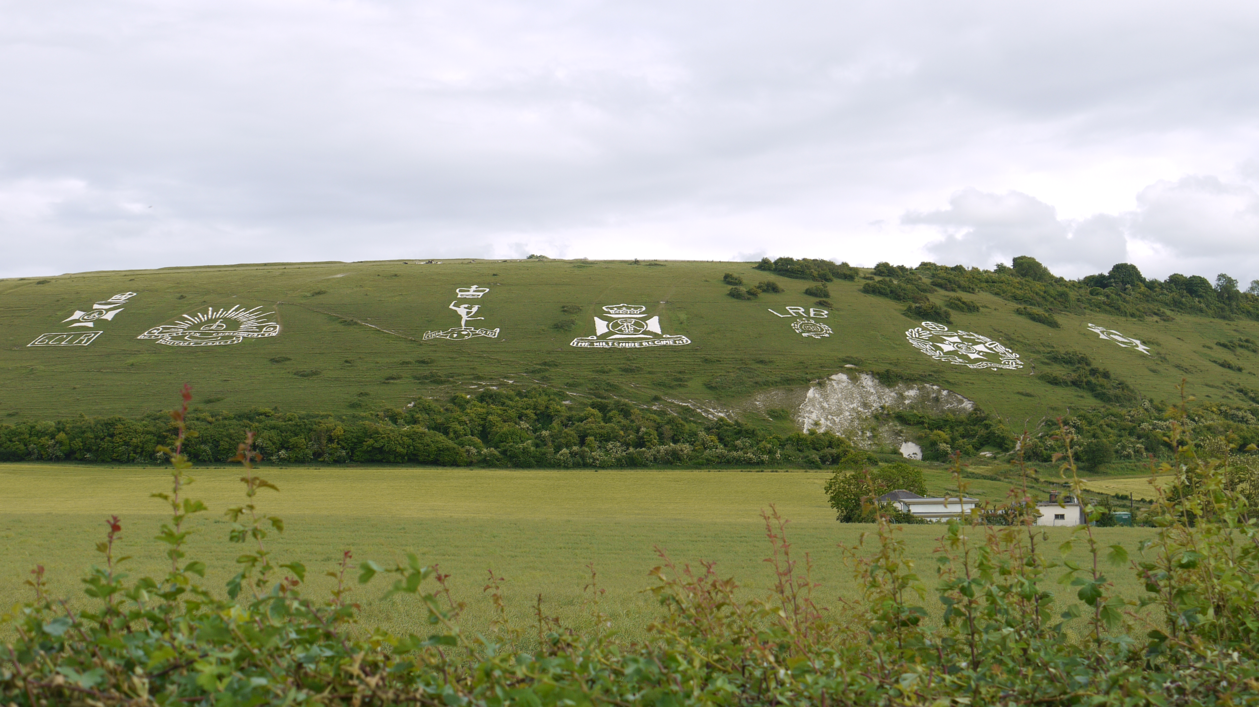
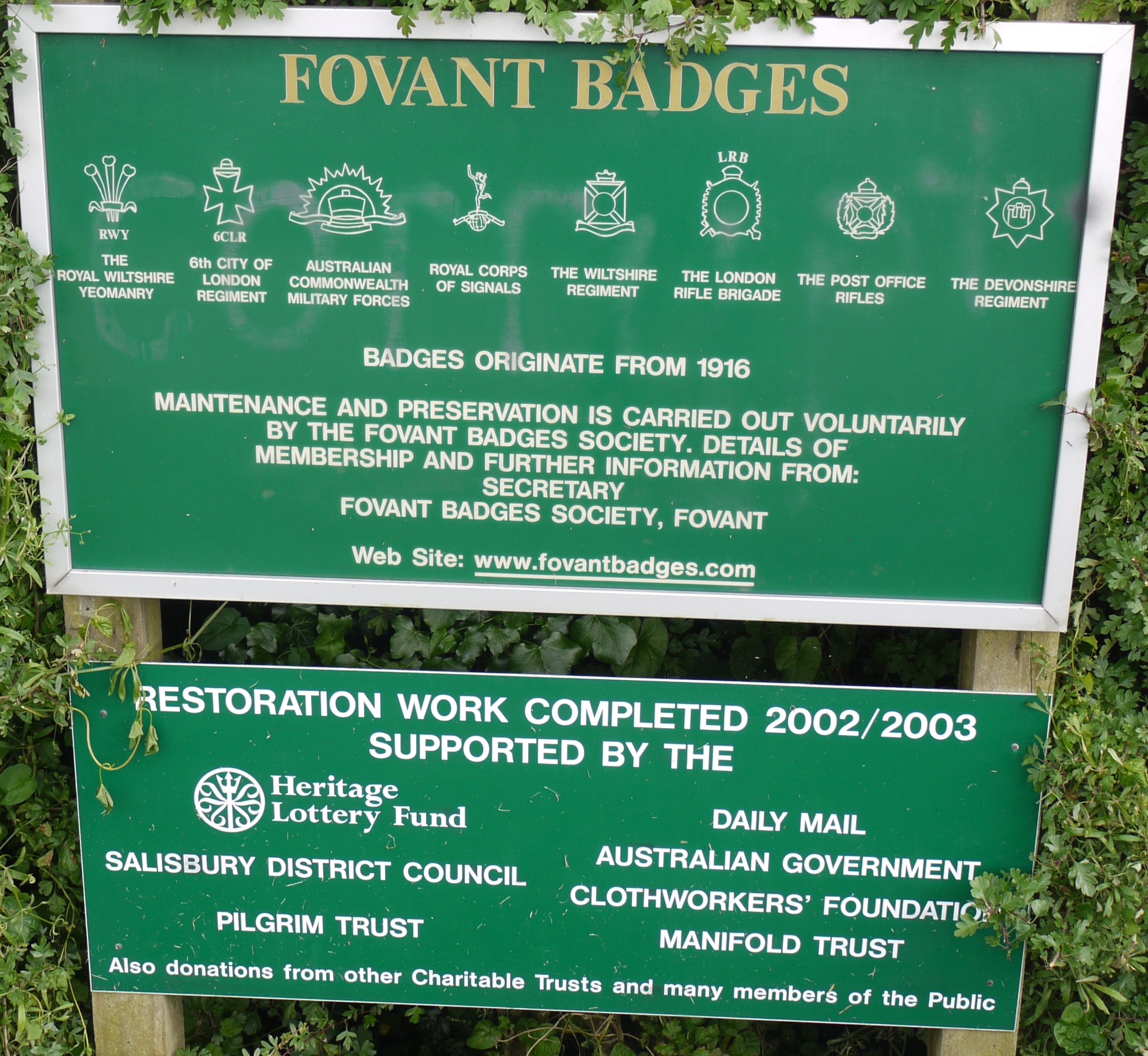
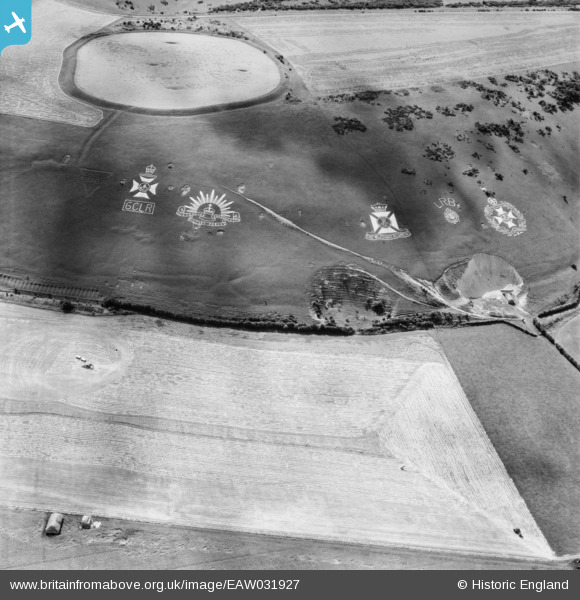
EAW031927 ENGLAND (1950). Chiselbury Camp hillfort and the Fovant Badges, Fovant, 1950
© Copyright OpenStreetMap contributors and licensed by the OpenStreetMap Foundation. 2026. Cartography is licensed as CC BY-SA.
Nearby Images (10)
EAW031927

EAW038619

EAW038618

EAW031929

EAW051994

EAW051990

EAW051995

EAW031930

EAW051989

EAW005105

Details
| Title | [EAW031927] Chiselbury Camp hillfort and the Fovant Badges, Fovant, 1950 |
| Reference | EAW031927 |
| Date | 17-August-1950 |
| Link | |
| Place name | FOVANT |
| Parish | FOVANT |
| District | |
| Country | ENGLAND |
| Easting / Northing | 401561, 128366 |
| Longitude / Latitude | -1.9777258516436, 51.054100785101 |
| National Grid Reference | SU016284 |
Pins
Be the first to add a comment to this image!