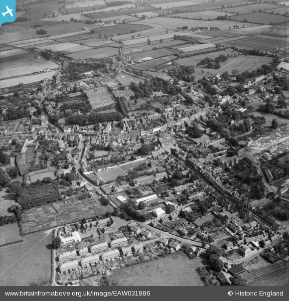
EAW031886 ENGLAND (1950). The town, Downham Market, 1950
    © Copyright OpenStreetMap contributors and licensed by the OpenStreetMap Foundation. 2025. Cartography is licensed as CC BY-SA.
  
Nearby Images (11)
Details
| Title | [EAW031886] The town, Downham Market, 1950 | 
| Reference | EAW031886 | 
| Date | 14-August-1950 | 
| Link | |
| Place name | DOWNHAM MARKET | 
| Parish | DOWNHAM MARKET | 
| District | |
| Country | ENGLAND | 
| Easting / Northing | 561099, 303230 | 
| Longitude / Latitude | 0.37913179454996, 52.60258142714 | 
| National Grid Reference | TF611032 | 
Pins
|  Stone Cross Lane |   Wissey | Thursday 16th of March 2023 01:55:25 PM | 
|  Rouses lane |   Wissey | Thursday 16th of March 2023 01:52:27 PM | 
|  Rouses lane |   Wissey | Thursday 16th of March 2023 01:52:24 PM | 
|  6th Form now moved to Bexwell road site.Buildings empty awaiting future developments ??? |   Wissey | Tuesday 10th of January 2023 04:53:58 PM | 
|  The Towers.(burnt down in1966) |   Wissey | Saturday 3rd of April 2021 11:05:54 AM | 
|  STONE CROSS ESTATE |   Wissey | Thursday 18th of March 2021 03:24:55 PM | 
|  Salamanca House |   chiffchaffbirdy | Sunday 27th of November 2016 07:45:27 PM | 
|  New Cemetery |   chiffchaffbirdy | Sunday 27th of November 2016 07:39:31 PM | 
|  This area was known as 'the eggpackers' by our old neighbours who moved the the Howdale in 1950s |   chiffchaffbirdy | Sunday 27th of November 2016 07:38:33 PM | 
|  The Old Workhouse |   chiffchaffbirdy | Sunday 27th of November 2016 07:37:24 PM | 
|  The old top stone of the public water fountain, moved to the Howdale in the 1950s. |   chiffchaffbirdy | Sunday 27th of November 2016 07:36:42 PM | 
|  Crown |   Mark | Wednesday 13th of April 2016 07:28:06 PM | 
|  Crown |   Mark | Wednesday 13th of April 2016 07:28:03 PM | 
|  Old Courthouse - now a private dwelling |   NorMan | Saturday 3rd of January 2015 01:36:21 PM | 
|  Town Hall |   NorMan | Saturday 3rd of January 2015 01:34:32 PM | 
 
             
  ![[EAW031886] The town, Downham Market, 1950](http://britainfromabove.org.uk/sites/all/libraries/aerofilms-images/public/100x100/EAW/031/EAW031886.jpg) 
  
                                          ![[EAW031884] The town, Downham Market, 1950](http://britainfromabove.org.uk/sites/all/libraries/aerofilms-images/public/100x100/EAW/031/EAW031884.jpg) 
 ![[EPW021517] The town centre, Downham Market, 1928](http://britainfromabove.org.uk/sites/all/libraries/aerofilms-images/public/100x100/EPW/021/EPW021517.jpg) 
 ![[EAW031887] The town, Downham Market, 1950](http://britainfromabove.org.uk/sites/all/libraries/aerofilms-images/public/100x100/EAW/031/EAW031887.jpg) 
 ![[EPW021463] The Town Centre, Downham Market, 1928](http://britainfromabove.org.uk/sites/all/libraries/aerofilms-images/public/100x100/EPW/021/EPW021463.jpg) 
 ![[EAW031885] The town centre, Downham Market, 1950](http://britainfromabove.org.uk/sites/all/libraries/aerofilms-images/public/100x100/EAW/031/EAW031885.jpg) 
 ![[EAW055113] The town centre, Downham Market, 1954](http://britainfromabove.org.uk/sites/all/libraries/aerofilms-images/public/100x100/EAW/055/EAW055113.jpg) 
 ![[EPW021518] Cannon Square and environs, Downham Market, 1928](http://britainfromabove.org.uk/sites/all/libraries/aerofilms-images/public/100x100/EPW/021/EPW021518.jpg) 
 ![[EPW021514] Bridge Street and environs, Downham Market, 1928](http://britainfromabove.org.uk/sites/all/libraries/aerofilms-images/public/100x100/EPW/021/EPW021514.jpg) 
 ![[EPW021515] Church Road and environs, Downham Market, 1928](http://britainfromabove.org.uk/sites/all/libraries/aerofilms-images/public/100x100/EPW/021/EPW021515.jpg) 
 ![[EPW021516] Clackclose School, Downham Market, 1928](http://britainfromabove.org.uk/sites/all/libraries/aerofilms-images/public/100x100/EPW/021/EPW021516.jpg)