
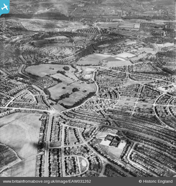
EAW031262 ENGLAND (1950). Longley Park and the Longley Estate, Sheffield, 1950
© Copyright OpenStreetMap contributors and licensed by the OpenStreetMap Foundation. 2026. Cartography is licensed as CC BY-SA.
Nearby Images (4)
EAW031262

EAW031259

EAW031260

EAW031261

Details
| Title | [EAW031262] Longley Park and the Longley Estate, Sheffield, 1950 |
| Reference | EAW031262 |
| Date | 26-July-1950 |
| Link | |
| Place name | SHEFFIELD |
| Parish | |
| District | |
| Country | ENGLAND |
| Easting / Northing | 435606, 391400 |
| Longitude / Latitude | -1.4641995021435, 53.417940244344 |
| National Grid Reference | SK356914 |
Pins
Be the first to add a comment to this image!