
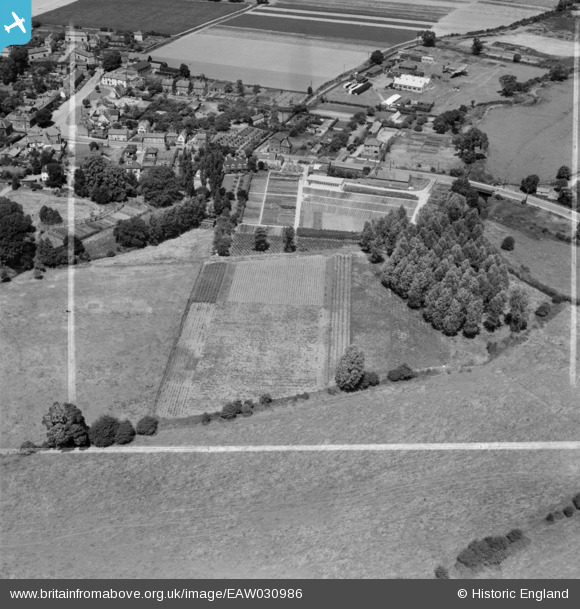
EAW030986 ENGLAND (1950). Cramphorn Ltd nursery on the south side of Bridge Street and environs, Writtle, 1950. This image was marked by Aerofilms Ltd for photo editing.
© Copyright OpenStreetMap contributors and licensed by the OpenStreetMap Foundation. 2025. Cartography is licensed as CC BY-SA.
Nearby Images (7)
EAW030986

EAW030982

EAW030985

EAW030980

EAW030983

EAW030981

EAW030984

Details
| Title | [EAW030986] Cramphorn Ltd nursery on the south side of Bridge Street and environs, Writtle, 1950. This image was marked by Aerofilms Ltd for photo editing. |
| Reference | EAW030986 |
| Date | 14-July-1950 |
| Link | |
| Place name | WRITTLE |
| Parish | WRITTLE |
| District | |
| Country | ENGLAND |
| Easting / Northing | 568070, 206084 |
| Longitude / Latitude | 0.43386723953696, 51.727786860934 |
| National Grid Reference | TL681061 |
Pins

Matt Aldred edob.mattaldred.com |
Saturday 7th of October 2023 09:09:30 PM | |
|
Matt Aldred edob.mattaldred.com |
Saturday 7th of October 2023 09:09:00 PM | |

Ian |
Sunday 27th of April 2014 09:13:46 AM | |
|
Ian |
Sunday 27th of April 2014 09:12:48 AM | |
|
Ian |
Sunday 27th of April 2014 09:11:26 AM | |
|
Ian |
Sunday 27th of April 2014 09:10:29 AM | |
|
Ian |
Sunday 27th of April 2014 09:09:39 AM | |
|
Ian |
Sunday 27th of April 2014 09:09:04 AM | |
|
Ian |
Saturday 26th of April 2014 10:07:00 PM |