
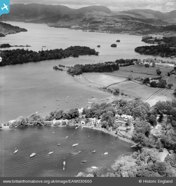
EAW030660 ENGLAND (1950). Sourpool Wyke, Cockshott Point and Lake Windermere, Ferry Nab, from the south-east, 1950
© Copyright OpenStreetMap contributors and licensed by the OpenStreetMap Foundation. 2025. Cartography is licensed as CC BY-SA.
Nearby Images (7)
EAW030660

EPW026738

EAW030657

EAW030658

EAW030661

EAW030659

EAW030662

Details
| Title | [EAW030660] Sourpool Wyke, Cockshott Point and Lake Windermere, Ferry Nab, from the south-east, 1950 |
| Reference | EAW030660 |
| Date | 30-June-1950 |
| Link | |
| Place name | FERRY NAB |
| Parish | WINDERMERE |
| District | |
| Country | ENGLAND |
| Easting / Northing | 339671, 495802 |
| Longitude / Latitude | -2.9283538826142, 54.354028876392 |
| National Grid Reference | SD397958 |
Pins
Be the first to add a comment to this image!