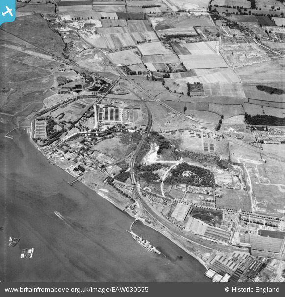
EAW030555 ENGLAND (1950). Beacon Hill and environs, Beacon Hill, 1950
© Copyright OpenStreetMap contributors and licensed by the OpenStreetMap Foundation. 2026. Cartography is licensed as CC BY-SA.
Nearby Images (9)
Details
| Title | [EAW030555] Beacon Hill and environs, Beacon Hill, 1950 |
| Reference | EAW030555 |
| Date | 28-June-1950 |
| Link | |
| Place name | BEACON HILL |
| Parish | |
| District | |
| Country | ENGLAND |
| Easting / Northing | 555478, 178548 |
| Longitude / Latitude | 0.23946422081767, 51.483997942375 |
| National Grid Reference | TQ555785 |
Pins

Matt Aldred edob.mattaldred.com |
Sunday 3rd of May 2020 05:38:39 PM |


![[EAW030555] Beacon Hill and environs, Beacon Hill, 1950](http://britainfromabove.org.uk/sites/all/libraries/aerofilms-images/public/100x100/EAW/030/EAW030555.jpg)
![[EAW030550] Purfleet Camp, Beacon Hill and environs, Beacon Hill, from the south-east, 1950](http://britainfromabove.org.uk/sites/all/libraries/aerofilms-images/public/100x100/EAW/030/EAW030550.jpg)
![[EAW030543] Tank Lane, London Road and the site of old chalk quarries at Botany, Beacon Hill, 1950](http://britainfromabove.org.uk/sites/all/libraries/aerofilms-images/public/100x100/EAW/030/EAW030543.jpg)
![[EAW030544] Tank Lane, London Road and the site of old chalk quarries at Botany, Beacon Hill, 1950](http://britainfromabove.org.uk/sites/all/libraries/aerofilms-images/public/100x100/EAW/030/EAW030544.jpg)
![[EAW030546] Beacon Hill and environs, Beacon Hill, 1950](http://britainfromabove.org.uk/sites/all/libraries/aerofilms-images/public/100x100/EAW/030/EAW030546.jpg)
![[EAW030547] Purfleet Camp, Beacon Hill and environs, Beacon Hill, from the north-west, 1950](http://britainfromabove.org.uk/sites/all/libraries/aerofilms-images/public/100x100/EAW/030/EAW030547.jpg)
![[EPW062019] Old chalk quarries above the railway station, Purfleet, 1939. This image has been produced from a print.](http://britainfromabove.org.uk/sites/all/libraries/aerofilms-images/public/100x100/EPW/062/EPW062019.jpg)
![[EAW030552] Purfleet and the River Thames, Beacon Hill, 1950](http://britainfromabove.org.uk/sites/all/libraries/aerofilms-images/public/100x100/EAW/030/EAW030552.jpg)
![[EAW030551] Beacon Hill and environs, Beacon Hill, from the south-east, 1950](http://britainfromabove.org.uk/sites/all/libraries/aerofilms-images/public/100x100/EAW/030/EAW030551.jpg)