
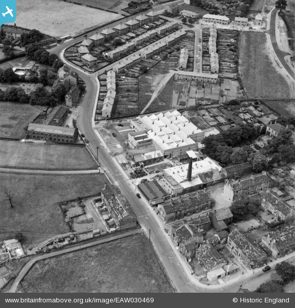
EAW030469 ENGLAND (1950). Roker Lane and the John G. Mohun & Son Ltd Alma Tannery, Pudsey, 1950
© Copyright OpenStreetMap contributors and licensed by the OpenStreetMap Foundation. 2026. Cartography is licensed as CC BY-SA.
Nearby Images (13)
EAW030469

EAW030463

EAW030470

EAW030466

EAW030462

EAW030464

EAW030467

EAW030468

EAW030460

EAW030471

EAW030472

EAW030461

EAW030465

Details
| Title | [EAW030469] Roker Lane and the John G. Mohun & Son Ltd Alma Tannery, Pudsey, 1950 |
| Reference | EAW030469 |
| Date | 22-June-1950 |
| Link | |
| Place name | PUDSEY |
| Parish | |
| District | |
| Country | ENGLAND |
| Easting / Northing | 422604, 432234 |
| Longitude / Latitude | -1.656887352375, 53.785720558083 |
| National Grid Reference | SE226322 |
Pins
Be the first to add a comment to this image!