
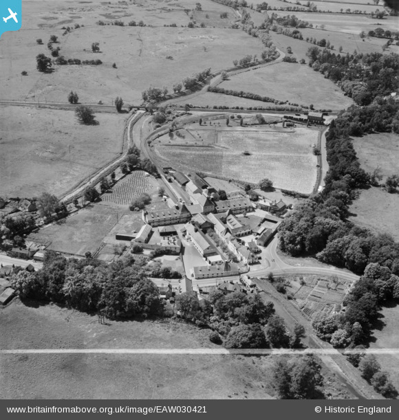
EAW030421 ENGLAND (1950). The Vynne and Everett Ltd Watermill, Narborough, 1950. This image was marked by Aerofilms Ltd for photo editing.
© Copyright OpenStreetMap contributors and licensed by the OpenStreetMap Foundation. 2026. Cartography is licensed as CC BY-SA.
Nearby Images (10)
EAW030421

EAW030416

EAW030418

EAW030417

EAW030414

EAW030420

EAW030415

EAW030413

EAW030419

EAW030422

Details
| Title | [EAW030421] The Vynne and Everett Ltd Watermill, Narborough, 1950. This image was marked by Aerofilms Ltd for photo editing. |
| Reference | EAW030421 |
| Date | 20-June-1950 |
| Link | |
| Place name | NARBOROUGH |
| Parish | NARBOROUGH |
| District | |
| Country | ENGLAND |
| Easting / Northing | 574534, 313280 |
| Longitude / Latitude | 0.58264683062708, 52.68869760486 |
| National Grid Reference | TF745133 |
Pins
Be the first to add a comment to this image!