
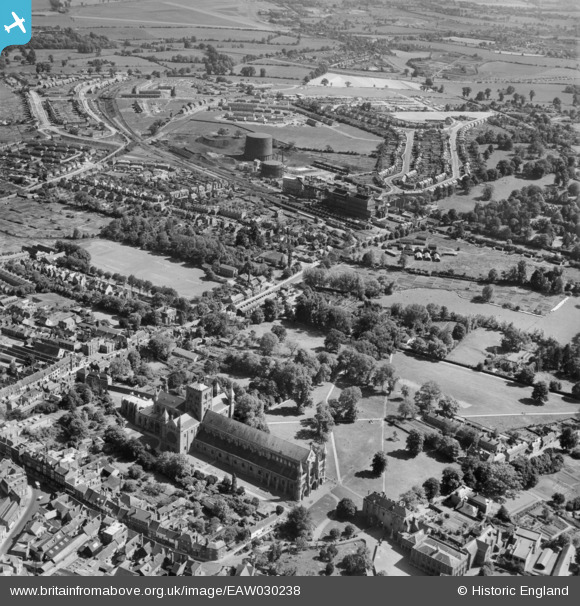
EAW030238 ENGLAND (1950). The Cathedral and Abbey Church of St Alban, Holywell Hill and environs, St Albans, 1950
© Copyright OpenStreetMap contributors and licensed by the OpenStreetMap Foundation. 2026. Cartography is licensed as CC BY-SA.
Nearby Images (7)
EAW030238

EAW030235

EAW030239

EPW001567

EAW027918

EAW030240

EPW025393

Details
| Title | [EAW030238] The Cathedral and Abbey Church of St Alban, Holywell Hill and environs, St Albans, 1950 |
| Reference | EAW030238 |
| Date | 12-June-1950 |
| Link | |
| Place name | ST ALBANS |
| Parish | |
| District | |
| Country | ENGLAND |
| Easting / Northing | 514538, 206674 |
| Longitude / Latitude | -0.34071760371431, 51.746586739568 |
| National Grid Reference | TL145067 |
Pins

Dom |
Thursday 9th of April 2020 10:35:29 AM |