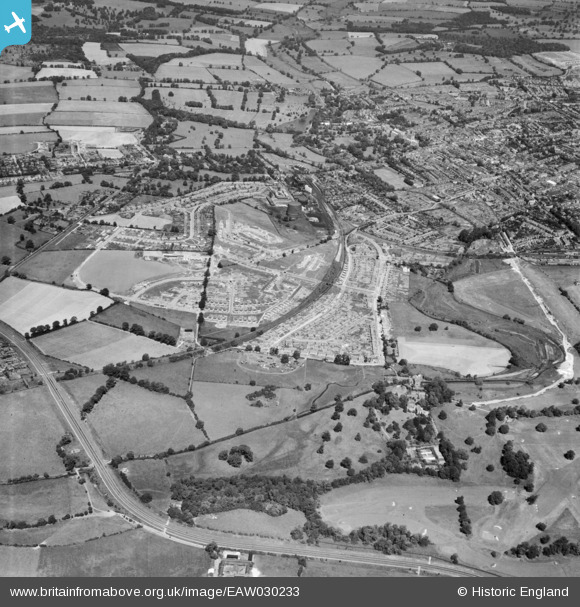
EAW030233 ENGLAND (1950). St Julian's and the city, St Albans, 1950
    © Copyright OpenStreetMap contributors and licensed by the OpenStreetMap Foundation. 2025. Cartography is licensed as CC BY-SA.
  
Details
| Title | [EAW030233] St Julian's and the city, St Albans, 1950 | 
| Reference | EAW030233 | 
| Date | 12-July-1950 | 
| Link | |
| Place name | ST ALBANS | 
| Parish | |
| District | |
| Country | ENGLAND | 
| Easting / Northing | 515047, 205632 | 
| Longitude / Latitude | -0.33369186901442, 51.737116595908 | 
| National Grid Reference | TL150056 | 
 
             
  ![[EAW030233] St Julian's and the city, St Albans, 1950](http://britainfromabove.org.uk/sites/all/libraries/aerofilms-images/public/100x100/EAW/030/EAW030233.jpg) 
  
                                          ![[EAW041250] Development of housing at Creighton Avenue and environs, St Julians, 1951](http://britainfromabove.org.uk/sites/all/libraries/aerofilms-images/public/100x100/EAW/041/EAW041250.jpg) 
 ![[EAW041252] Development of housing at Creighton Avenue and environs, St Julians, 1951](http://britainfromabove.org.uk/sites/all/libraries/aerofilms-images/public/100x100/EAW/041/EAW041252.jpg) 
  Cereals Research Station, Old London Road
 Cereals Research Station, Old London Road