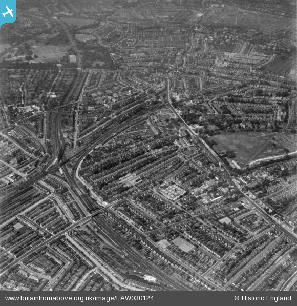
EAW030124 ENGLAND (1950). Greyhound Lane, Streatham High Road and environs, Streatham, 1950. This image has been produced from a print.
© Copyright OpenStreetMap contributors and licensed by the OpenStreetMap Foundation. 2026. Cartography is licensed as CC BY-SA.
Details
| Title | [EAW030124] Greyhound Lane, Streatham High Road and environs, Streatham, 1950. This image has been produced from a print. |
| Reference | EAW030124 |
| Date | 6-June-1950 |
| Link | |
| Place name | STREATHAM |
| Parish | |
| District | |
| Country | ENGLAND |
| Easting / Northing | 529929, 170902 |
| Longitude / Latitude | -0.13111431098556, 51.42172565602 |
| National Grid Reference | TQ299709 |
Pins

Post-war prefabs |
Thursday 7th of November 2019 11:20:01 AM | |

Post-war prefabs |
Thursday 7th of November 2019 11:16:56 AM | |

Post-war prefabs |
Thursday 7th of November 2019 11:15:10 AM | |

Post-war prefabs |
Thursday 7th of November 2019 11:14:04 AM | |

Post-war prefabs |
Thursday 7th of November 2019 11:12:17 AM | |

Post-war prefabs |
Thursday 7th of November 2019 11:11:45 AM | |

taxiphil |
Friday 27th of May 2016 04:12:42 PM | |

taxiphil |
Friday 27th of May 2016 04:09:04 PM | |

Rob |
Sunday 16th of November 2014 02:12:39 PM | |

Rob |
Sunday 16th of November 2014 02:11:16 PM | |

lletob |
Thursday 30th of October 2014 07:38:26 PM | |

lletob |
Thursday 30th of October 2014 07:37:29 PM | |

lletob |
Thursday 30th of October 2014 07:36:13 PM | |

lletob |
Thursday 30th of October 2014 07:29:58 PM | |

lletob |
Thursday 30th of October 2014 07:28:56 PM | |

brianbeckett |
Thursday 18th of September 2014 07:57:31 PM |


![[EAW030124] Greyhound Lane, Streatham High Road and environs, Streatham, 1950. This image has been produced from a print.](http://britainfromabove.org.uk/sites/all/libraries/aerofilms-images/public/100x100/EAW/030/EAW030124.jpg)
![[EPW055321] The Streatham High Road and environs, Streatham, from the south, 1937](http://britainfromabove.org.uk/sites/all/libraries/aerofilms-images/public/100x100/EPW/055/EPW055321.jpg)